
Wheeling in Ohio County, West Virginia — The American South (Appalachia)
Gibson-Linn
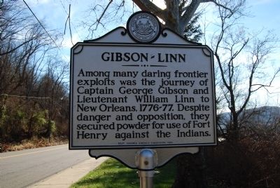
Photographed by Mike Wintermantel, December 26, 2014
1. Gibson-Linn Marker
Erected 1964 by West Virginia Historic Commission.
Topics and series. This historical marker is listed in these topic lists: Exploration • Forts and Castles • Indigenous Peoples and Communities. In addition, it is included in the West Virginia Archives and History series list.
Location. 40° 4.562′ N, 80° 43.372′ W. Marker is in Wheeling, West Virginia, in Ohio County. It is on Stone Boulevard 0.2 miles north of West Chapline Street, on the right when traveling south. Touch for map. Marker is in this post office area: Wheeling WV 26003, United States of America. Touch for directions.

Regionally, this marker is in the Northern Panhandle and in the High Valley. It is also in the American South, specifically in the Upper South, in the Ohio River Valley, in Appalachia, and specifically in Northern Appalachia. Globally, it is in North
this page online
Other nearby markers. At least 8 other markers are within walking distance of this marker: The E.G. Kramer House (about 600 feet away, measured in a direct line); 647 Main Street (about 700 feet away); The Phillips House (about 700 feet away); 659 Main Street (about 700 feet away); 612 Main Street (about 700 feet away); The Goering House (about 700 feet away); 623 Main Street (about 700 feet away); Samuel Irwin House (about 800 feet away). Touch for a list and map of all markers in Wheeling.
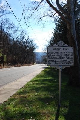
Photographed by Mike Wintermantel, December 26, 2014
2. Gibson-Linn Marker
Credits. This page was last revised on June 16, 2016. It was originally submitted on December 26, 2014, by Mike Wintermantel of Pittsburgh, Pennsylvania. This page has been viewed 872 times since then and 41 times this year. Photos: 1, 2. submitted on December 26, 2014, by Mike Wintermantel of Pittsburgh, Pennsylvania.
