Louisbourg in Cape Breton Region, Nova Scotia — The Atlantic Provinces (North America)
Wolfe’s Landing
Le débarquement de Wolfe
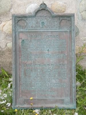
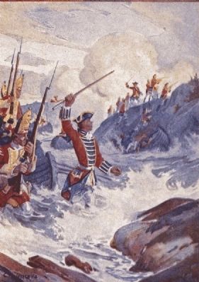
Here, 8th June, 1758, the men of Brigadier General James Wolfe’s brigade, after having been repulsed with heavy loss by the French troops entrenched westward made their gallant and successful landing.
Thus began the operation which ended on 26th July by the capitulation of Louisbourg.
French:
Le 8 juin 1758, les soldats de la brigade du Général James Wolfe, après avoir été repoussés avec grandes pertes par les français retranchés à l’ouest assurèrent par leur audace leur descente en cet endroit.
Ce fut le début de la campagne qui devait se terminer par la capitulation de Louisbourg, 29 juillet.
Erected 1956 by Historic Sites and Monument Board of Canada/Commission de lieux et monuments historique du Canada.
Topics and series. This historical marker is listed in this topic list: War, French and Indian. In addition, it is included in the Acadian History, and the Canada, Historic Sites and Monuments Board series lists. A significant historical date for this entry is June 8, 1758.
Location. 45° 52.725′ N, 60° 3.27′ W. Marker is in Louisbourg, Nova Scotia, in Cape Breton Region. Marker can be reached from Kennington Cove Road. Touch for map. Marker is in this post office area: Louisbourg NS B1C 2L2, Canada. Touch for directions.
Other nearby markers. At least 8 other markers are within 8 kilometers of this marker, measured as the crow flies. The Siege Landing (about 180 meters away, measured in a direct line); Canada’s First Observatory (approx. 5.5 kilometers away); Fizel House (approx. 5.6 kilometers away); Slavery / Freedom (approx. 5.6 kilometers away); Marie Marguerite Rose (approx. 5.6 kilometers away); Fortress of Louisbourg (approx. 6.4 kilometers away); The Lobster Fishery (approx. 7.6 kilometers away); 19th-Century Lighthouse (approx. 8.1 kilometers away). Touch for a list and map of all markers in Louisbourg.
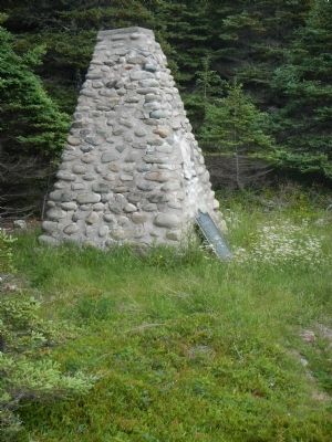
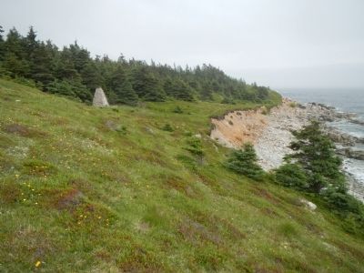
More about this marker. Kennington Cove is locate about 5 km south west of Fortress Louisbourg on Kennington Cove Road. The marker can be located by taking a poorly marked trail to the left of the parking lot, across a small bridge and around the point.
Also see . . . Siege of Louisbourg (1758) - Wikpedia. French defenses were initially successful and after heavy losses, Wolfe ordered a retreat. However, at the last minute, a boatload of light infantry in Wolfe's division (i.e., members of Rogers Rangers) found a rocky inlet protected from French fire and secured a beach head. Wolfe redirected the rest of his division to follow. (Submitted on December 28, 2014, by Barry Swackhamer of Brentwood, California.)
Credits. This page was last revised on June 16, 2016. It was originally submitted on December 28, 2014, by Barry Swackhamer of Brentwood, California. This page has been viewed 476 times since then and 25 times this year. Photos: 1, 2, 3, 4. submitted on December 28, 2014, by Barry Swackhamer of Brentwood, California. • Andrew Ruppenstein was the editor who published this page.


