Near Louisbourg in Cape Breton Region, Nova Scotia — The Atlantic Provinces (North America)
First Lighthouse Tower
Photographed by Barry Swackhamer, July 3, 2014
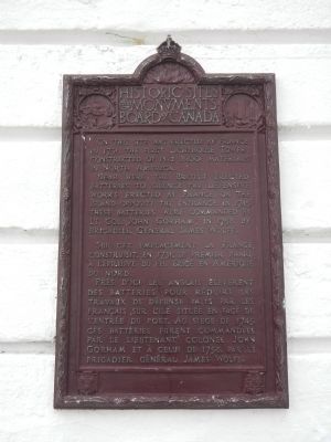
1. First Lighthouse Tower Marker

English:
On this site was erected by France, in 1731, the first Lighthouse Tower, constructed of fireproof materials, in North America.
Near here the British erected batteries to silence the defensive works erected by France. In 1745, these batteries were commanded by Lt. Co. John Gorham; in 1758, by Brigadier General James Wolfe.
French:
Près d’ici les anglais élevèrent des batteries pour réduire les travaux de défense fait par les français sur l’ile située en face de l’entrée du port. Au siège de 1745, ce batteries furent commandées par le lieutenant colonel John Gorham et à celui de 1758, pare le brigadier général James Wolfe.
Erected 1926 by Historic Sites and Monument Board of Canada/Commission de lieux et monuments historique du Canada.
Topics and series. This historical marker is listed in these topic lists: Communications • War, French and Indian • Waterways & Vessels. In addition, it is included in the Canada, Historic Sites and Monuments Board, and the
this page online
Location. 45° 54.397′ N, 59° 57.508′ W. Marker is near Louisbourg, Nova Scotia, in Cape Breton Region. It can be reached from Havenside Road, on the left when traveling east. Touch for map. Marker is at or near this postal address: 573 Havenside Road, Louisbourg NS B1C 1P4, Canada. Touch for directions.

Regionally, this marker is on Nova Scotia’s Cape Breton Island. It is also in the Maritimes and in Atlantic Canada. Globally, it is in the North Atlantic Region, North America, the Western Hemisphere, the Western World, and the Anglosphere. Historically, it finds itself in what was once a British colony, the Viceroyalty of New France, and Acadia.
Other nearby markers. At least 8 other markers are within 3 kilometers of this marker, measured as the crow flies: French Garrison at Louisbourg (here, next to this marker); First Lighthouse (here, next to this marker); 19th-Century Lighthouse (here, next to this marker); Louisbourg Harbour (within shouting distance of this marker); Lighthouse Point (within shouting distance of this marker); Kennelly Point
Photographed by Barry Swackhamer, July 3, 2014
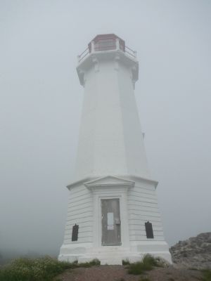
2. First Lighthouse Tower Marker
More about this marker. This marker is located on the lighthouse at the end of Havenside Road.
Credits. This page was last revised on October 22, 2025. It was originally submitted on December 29, 2014, by Barry Swackhamer of Brentwood, California. This page has been viewed 615 times since then and 21 times this year. Photos: 1, 2. submitted on December 29, 2014, by Barry Swackhamer of Brentwood, California. • Andrew Ruppenstein was the editor who published this page.
