Margaree Forks in Inverness County, Nova Scotia — The Atlantic Provinces (North America)
The Margaree-Lake Ainslie River System
Le Réseau Fluvial Margaree-Lac Ainslie
— The Canadian Heritage Rivers System / Le Réseau de rivières du patrimoine canadien —
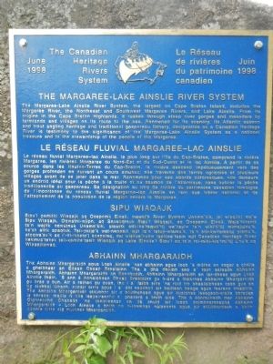
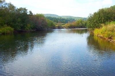
The Margaree-Lake Ainslie River System, the largest on Cape Breton Island, includes the Margaree River, the Northeast and Southwest Margaree Rivers, and Lake Ainslie. From its origins in the Cape Breton Highlands, it rushes through steep river gorges and meanders by farmlands and villages on its route to the sea. Renowned for is scenery, its Atlantic salmon and trout angling heritage and traditional gaspereau fishery, designation as a Canadian Heritage River is testimony to the significance of the Margaree-Lake Ainslie System as a national treasure and to the stewardship of the people of the Margaree.
French:
Sipu’l pemitkl Wiaqajk aq Qospemk Einsli, mawki’k River System Uama’kik, jel wiaqitkl ma’w Sipu Wiaqajk, Oquwatni-wjpn, aq Snusoqtnuk Sipu’l wiaqajk, aq Qospemk Einsli. Weja’tekemk ta’n wejitk oqwatnuk Unama’kik, siawitk etli-ika’taquti’tij we’kayiw ta’n wiki’ti’tij minajuinu’k, ke’sk elitk apaqtuk. Teli-pkije’k wet-nenasik wjit ta’n retuj-wlamu’k, ta’n etli-kwitamaluj plamu’k, atoqwa’su’k aq i’-tli-mketo’j kaspalaq, mu wiskue’nukw tepkisa’tasin wjit Canadian Heritage River kekinua’tekek teli-komite’tasik Wiaqajk aq Lake Einslie’l Sipu’l aq ta’n tel-miki-kio’tmi’tij L’nu’k aq Wiaqajkewaq.
Tha Abhainn Mhargaraidh agus Lock Ainslie ‘nan abrainn agus loch ’s mótha an eagar a chéile agheibher an eilean Cheap Breatainn. Tha a dhà dhiubh seo a’ toirt asteach Abhain Mhargaraidh, Abhainn Mhargaidh an Ear-thuath, Abhainn Mhargaraidh an lar-dheas agus Loch Ainslie fhéin. ’S ann á Aonaichean Cheap Breatainn gu h-árd a theàrnas Abhainn Mhargaraidh gu brai o bun. Air a arthad gu cuan, tha i a’ falbh sios ‘na roid tro bhealaichean casa gus an tig siubhal lùbach, socair oirre agus i a’ dol seachad air bailtean beaga agus fearann treabhta. Tha Abhainn Mhargaraidh cliùmhor air a bòidhchead agus air dualchas iasagach-siaite bhradan is bhreac, maille ri nós iasgaireachd a’ ghasprà a bhith aice. Tha a sònrachadh mar Abhainn Oighreachd Chanada ‘na theisteanas an dà chuid air luach coimhearsnachd Abhainn Mhargaraidh - Loch Ainslie a bhith na h-ionmhas nàseanta agus air stiùbhardach a bhithmdèante oirre aig muinntir Mhargaraidh.
Erected 1998 by The Canadian Heritage Rivers System / Le Réseau de rivières du patrimoine canadien.
Topics. This historical marker is listed in this topic list: Waterways & Vessels.
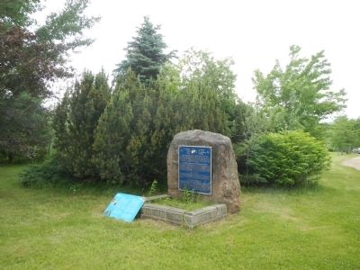
Location. 46° 20.026′ N, 61° 5.813′ W. Marker is in Margaree Forks, Nova Scotia, in Inverness County. Marker is on Cabot Trail close to Nova Scotia Route 19, on the right when traveling west. Touch for map. Marker is at or near this postal address: 7962 Cabot Trail, Margaree Forks NS B0E 2A0, Canada. Touch for directions.
Other nearby markers. At least 5 other markers are within 23 kilometers of this marker, measured as the crow flies. Margaree River (here, next to this marker); Dr. Moses Coady and Father Jimmy Tompkins (a few steps from this marker); Belle Côte War Memorial (approx. 12.3 kilometers away); St. Joseph du Moine War Memorial (approx. 21.7 kilometers away); Founders of the Parish of St-Joseph du Moine (approx. 21.8 kilometers away).
More about this marker. This marker is located near the Library/Information Center.
Also see . . . Margaree River - Wikipedia. During the 18th century, Acadians settled along the coast near the mouth of the river; the French name for this river was St. Marguerite. Scottish Highlanders began to settle in the Margaree Valley at the beginning of the 19th century. (Submitted on January 2, 2015, by Barry Swackhamer of Brentwood, California.)
Credits. This page was last revised on October 8, 2019. It was originally submitted on January 2, 2015, by Barry Swackhamer of Brentwood, California. This page has been viewed 399 times since then and 11 times this year. Photos: 1, 2, 3. submitted on January 2, 2015, by Barry Swackhamer of Brentwood, California. • Andrew Ruppenstein was the editor who published this page.


