Near Pensacola Beach in Escambia County, Florida — The American South (South Atlantic)
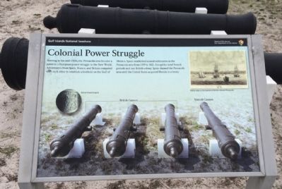
Colonial Power Struggle
| — | Fort Pickens | — |
Photographed by Mark Hilton, December 31, 2014
1. Colonial Power Struggle Marker
Erected by the National Park Service, Department of the Interior.
Topics. This historical marker is listed in these topic lists: Colonial Era • Exploration • Forts and Castles. A significant historical year for this entry is 1559.
Location. 30° 19.739′ N, 87° 17.568′ W. Marker is near Pensacola Beach, Florida, in Escambia County. It is on Fort Pickens Road 9.8 miles west of Pensacola Beach Boulevard (State Road 399), on the right when traveling south. Touch for map. Marker is at or near this postal address: Fort Pickens Road, Gulf Breeze FL 32561, United States of America. Touch for directions.

Regionally, this marker is in Greater Pensacola and on the Florida Panhandle.
this page online
Other nearby markers. At least 8 other markers are within walking distance of this marker: Hurricane Ivan (within shouting distance of this marker); From the Fort to these Wooden Buildings (within shouting distance of this marker); Battery Cullum, Battery Sevier (about 700 feet away, measured in a direct line); Beefing Up Defenses (about 700 feet away); Dueling with Confederates (about 700 feet away); Swatting Mosquitoes (about 800 feet away); Massive Smoothbore (about 800 feet away); Deadly Explosion (approx. 0.2 miles away). Touch for a list and map of all markers in Pensacola Beach.
Another marker is no longer nearby. Battery Langdon (was approx. 0.2 miles away but has been confirmed missing).
Photographed by Mark Hilton, December 31, 2014
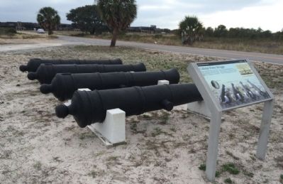
2. Colonial Power Struggle Marker & British and Spanish Cannons
Photographed by Mark Hilton, December 31, 2014
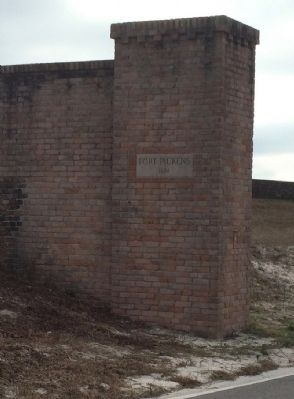
3. Main Fort entrance
Photographed by Mark Hilton, January 1, 2015
4. Fort Pickens area entrance sign
Credits. This page was last revised on August 1, 2017. It was originally submitted on January 2, 2015, by Mark Hilton of Montgomery, Alabama. This page has been viewed 569 times since then and 26 times this year. Photos: 1, 2, 3, 4. submitted on January 2, 2015, by Mark Hilton of Montgomery, Alabama.
