Baxter Springs in Cherokee County, Kansas — The American Midwest (Upper Plains)
Baxter Springs Massacre
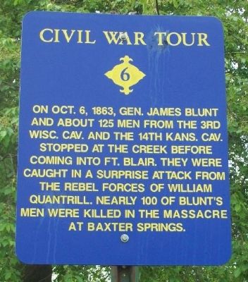
Civil War Tour
On Oct. 6, 1863, Gen. James Blunt and about 125 men from the 3rd Wisc. Cav. and the 14th Kans. Cav. stopped at the creek before coming into Ft. Blair. They were caught in a surprise attack from the rebel forces of William Quantrill. Nearly 100 of Blunt's men were killed in the massacre at Baxter Springs.
Erected by City of Baxter Springs. (Marker Number 6.)
Topics and series. This historical marker is listed in this topic list: War, US Civil. In addition, it is included in the Kansas, Baxter Springs Civil War Tour series list. A significant historical year for this entry is 1863.
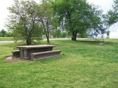
Location. 37° 2.171′ N, 94° 44.113′ W. Marker is in Baxter Springs, Kansas, in Cherokee County. Marker is on Military Avenue (U.S. 69), on the right when traveling south. Marker is in Military Park, opposite Baxter Springs High School. Touch for map. Marker is in this post office area: Baxter Springs KS 66713, United States of America. Touch for directions.
Other nearby markers. At least 8 other markers are within walking distance of this marker. Baxter Springs Massacre 1863 (a few steps from this marker); Baxter Springs, Kansas (a few steps from this marker); Civil War Tour (approx. 0.3 miles away); The Earliest Residents (approx. 0.3 miles away); Baxter Springs: from Fort to Town (approx. 0.3 miles away); Tbe Economic Engines (approx. 0.3 miles away); Baxter Springs Massacre Burial Site (approx. 0.4 miles away); John Baxter (approx. 0.4 miles away). Touch for a list and map of all markers in Baxter Springs.
Also see . . .
1. Fort Blair & the Baxter Springs Massacre. Legends of America website entry (Submitted on January 10, 2015, by William Fischer, Jr. of Scranton, Pennsylvania.)
2. Baxter Springs City Cemetery Soldiers' Lot. VA National Cemetery Administration website entry (Submitted on January 10, 2015, by William Fischer, Jr. of Scranton, Pennsylvania.)
3. Blunt's Flag Captured by Quantrill's Raiders. Kansas Historical Society website entry (Submitted on January 10, 2015, by William Fischer, Jr. of Scranton, Pennsylvania.)
Credits. This page was last revised on September 7, 2023. It was originally submitted on January 10, 2015, by William Fischer, Jr. of Scranton, Pennsylvania. This page has been viewed 882 times since then and 25 times this year. Photos: 1, 2. submitted on January 10, 2015, by William Fischer, Jr. of Scranton, Pennsylvania.

