Baxter Springs in Cherokee County, Kansas — The American Midwest (Upper Plains)
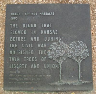
Baxter Springs Massacre 1863
The blood that flowed in Kansas before and during the Civil War nourished the twin trees of Liberty and Union.
Erected 1969 by United States Department of the Interior, National Park Service and the City of Baxter Springs.
Topics. This memorial is listed in these topic lists: Settlements & Settlers • War, US Civil.
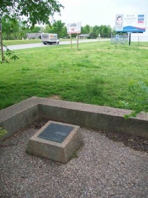
Location. 37° 2.167′ N, 94° 44.109′ W. Marker is in Baxter Springs, Kansas, in Cherokee County. Memorial is on Military Avenue (U.S. 69). Marker is in Military Park, opposite Baxter Springs High School. Touch for map. Marker is in this post office area: Baxter Springs KS 66713, United States of America. Touch for directions.
Other nearby markers. At least 8 other markers are within walking distance of this marker. Baxter Springs Massacre (a few steps from this marker); Baxter Springs, Kansas (a few steps from this marker); Civil War Tour (approx. 0.3 miles away); The Earliest Residents (approx. 0.3 miles away); Baxter Springs: from Fort to Town (approx. 0.3 miles away); Tbe Economic Engines (approx. 0.3 miles away); Baxter Springs Massacre Burial Site (approx. 0.4 miles away); John Baxter (approx. 0.4 miles away). Touch for a list and map of all markers in Baxter Springs.
Also see . . .
1. Fort Blair & the Baxter Springs Massacre. Legends of America website entry (Submitted on January 10, 2015, by William Fischer, Jr. of Scranton, Pennsylvania.)
2. Baxter Springs City Cemetery Soldiers' Lot. VA National Cemetery Administration website entry (Submitted on January 10, 2015, by William Fischer, Jr. of Scranton, Pennsylvania.)
Credits. This page was last revised on September 7, 2023. It was originally submitted on January 10, 2015, by William Fischer, Jr. of Scranton, Pennsylvania. This page has been viewed 717 times since then and 21 times this year. Photos: 1, 2. submitted on January 10, 2015, by William Fischer, Jr. of Scranton, Pennsylvania.

