Baxter Springs in Cherokee County, Kansas — The American Midwest (Upper Plains)
Quantrill's Raiders Prepare to Attack Fort Blair
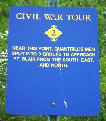
Civil War Tour
Inscription.
Near this point, Quantrill's men split into 3 groups to approach Ft. Blair from the south, east, and north.
Erected by City of Baxter Springs. (Marker Number 2.)
Topics and series. This historical marker is listed in these topic lists: Forts and Castles • War, US Civil. In addition, it is included in the Kansas, Baxter Springs Civil War Tour series list.
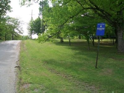
Location. 37° 1.541′ N, 94° 43.57′ W. Marker is in Baxter Springs, Kansas, in Cherokee County. Marker is on 10th Street, on the left when traveling east. Marker is in Kiwanis Park, about 150 feet east of the intersection of 10th Street with Fairview Avenue. Touch for map. Marker is in this post office area: Baxter Springs KS 66713, United States of America. Touch for directions.
Other nearby markers. At least 8 other markers are within walking distance of this marker. Quantrill's Raiders Ford Spring River (approx. ¼ mile away); Quantrill's Raiders Kill Johnny Fry (approx. ¼ mile away); The Zellekin Brewery (approx. 0.4 miles away); Log Cabin (approx. 0.4 miles away); Last Pratt Pony Truss Bridge in Cherokee County (approx. 0.4 miles away); Veterans Memorial (approx. 0.4 miles away); Black Dog Trail (approx. half a mile away); Phillips 66 Petroleum Company Gas Station (approx. half a mile away). Touch for a list and map of all markers in Baxter Springs.
Also see . . .
1. Fort Blair & the Baxter Springs Massacre. (Submitted on January 10, 2015, by William Fischer, Jr. of Scranton, Pennsylvania.)
2. Blunt's Flag Captured by Quantrill's Raiders. (Submitted on January 10, 2015, by William Fischer, Jr. of Scranton, Pennsylvania.)
Credits. This page was last revised on September 1, 2020. It was originally submitted on January 10, 2015, by William Fischer, Jr. of Scranton, Pennsylvania. This page has been viewed 526 times since then and 9 times this year. Photos: 1, 2. submitted on January 10, 2015, by William Fischer, Jr. of Scranton, Pennsylvania.

