Tollgate in Ritchie County, West Virginia — The American South (Appalachia)
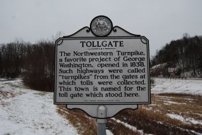
Tollgate
Erected 2009 by West Virginia Archives & History.
Topics and series. This historical marker is listed in this topic list: Roads & Vehicles. In addition, it is included in the West Virginia Archives and History series list. A significant historical year for this entry is 1838.
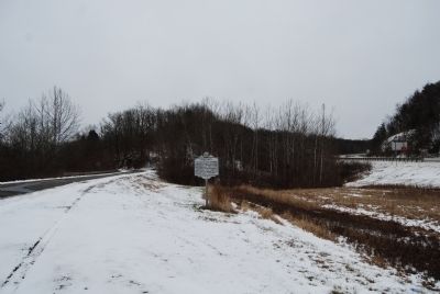
Location. Marker is missing. It was located near 39° 16.144′ N, 80° 54.967′ W. Marker was in Tollgate, West Virginia, in Ritchie County. Marker was at the intersection of Cabin Run Road (County Route 10) and U.S. 50, on the right when traveling north on Cabin Run Road. Touch for map. Marker was in this post office area: Pennsboro WV 26415, United States of America. Touch for directions.
Other nearby markers. At least 8 other markers are within 8 miles of this location, measured as the crow flies. Doddridge County / Ritchie County (approx. 0.7 miles away); Harrisville (approx. 3 miles away); Pennsboro B&O Depot (approx. 3 miles away); Pennsboro (approx. 3.1 miles away); The Stone House (approx. 3.2 miles away); Ephraim Bee (approx. 4.6 miles away); Central Station Bridge (approx. 5.4 miles away); Romeo H. Freer (approx. 7.7 miles away).
Credits. This page was last revised on May 14, 2022. It was originally submitted on January 11, 2015, by Mike Wintermantel of Pittsburgh, Pennsylvania. This page has been viewed 430 times since then and 27 times this year. Photos: 1, 2. submitted on January 11, 2015, by Mike Wintermantel of Pittsburgh, Pennsylvania.

