Memphis in Saunders County, Nebraska — The American Midwest (Upper Plains)
The Armour and Company Icehouse
Photographed by Joan Shurtliff, January 19, 2015
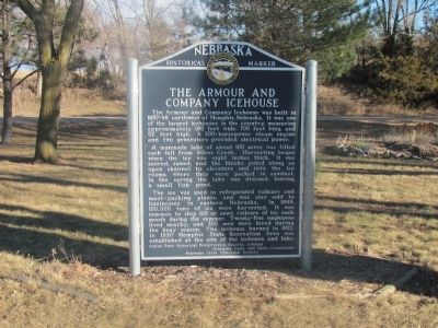
1. The Armour and Company Icehouse Marker
A manmade lake of about 100 acres was filled each fall from Silver Creek. Harvesting began when the ice was eight inches thick. It was scored, sawed, and the blocks poled along an open channel to elevators and into the ice rooms, where they were packed in sawdust. In the spring the lake was drained, leaving a small fish pond.
The ice was used in refrigerated railcars and meat-packing plants, and was also sold to businesses in eastern Nebraska. In 1899, 100,000 tons of ice were harvested. It was common to ship 100 or more railcars of ice each month during the summer. Twenty-five employees lived nearby, and 300 men were hired during the busy season. The icehouse burned in 1921. In 1930 Memphis State Recreation Area was established at the site of the icehouse and lake.
Ashland-Saline Ford Historical Preservation Society, 1998
Nebraska
this page online
Nebraska State Historical Society
Memphis State Recreation Area, on Nebr. 63 at Memphis
Saunders County
Marker 409
Erected 1998 by Ashland-Saline Ford Historical Preservation Society; Nebraska Games and Park Commission; Nebraska State Historical Society. (Marker Number 409.)
Topics and series. This historical marker is listed in these topic lists: Industry & Commerce • Waterways & Vessels. In addition, it is included in the Nebraska State Historical Society series list. A significant historical year for this entry is 1899.
Location. 41° 5.876′ N, 96° 26.191′ W. Marker is in Memphis, Nebraska, in Saunders County. It is on State Highway 63. This marker is located at the Memphis State Recreation Area just west of Memphis, Nebraska. Touch for map. Marker is in this post office area: Memphis NE 68042, United States of America. Touch for directions.

Regionally, this marker is in Eastern Nebraska and in Greater Lincoln. It is also in the American Midwest, in the Corn Belt, and on the prairies. Globally, it is in North America, the Western Hemisphere, the Western World, and the Anglosphere.
Photographed by Joan Shurtliff, January 19, 2015
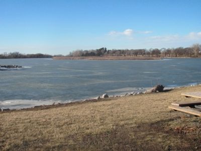
2. The Armour and Company Icehouse Marker
This is the pond where the ice was harvested.
Other nearby markers. At least 8 other markers are within 9 miles of this marker, measured as the crow flies: The Mormon Pioneer Trail (approx. 5½ miles away); In Honor Of John McBride Belnap (approx. 5.6 miles away); The Ox-Bow Trail (approx. 5.8 miles away); Atlas D Missile Site A-1 (approx. 6 miles away); a different marker also named Atlas D Missile Site A-1 (approx. 6½ miles away); Prehistoric Burial Site (approx. 7.8 miles away); Melia (approx. 8.4 miles away); Native Americans in the Lower Platte Valley (approx. 8½ miles away).
Credits. This page was last revised on December 22, 2024. It was originally submitted on January 21, 2015, by Joan Shurtliff of Seward, Nebraska. This page has been viewed 1,074 times since then and 56 times this year. Photos: 1, 2. submitted on January 21, 2015, by Joan Shurtliff of Seward, Nebraska. • Andrew Ruppenstein was the editor who published this page.
Editor’s want-list for this marker. A wide shot of the marker and its surroundings. • Can you help?
