Stratford Hills in Richmond, Virginia — The American South (Mid-Atlantic)
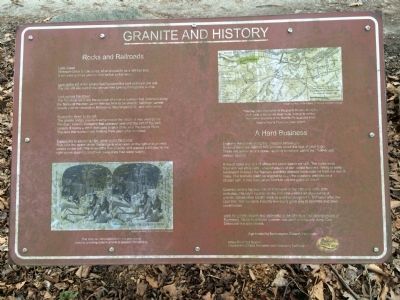
Granite and History
Look Ahead
Riverside Drive is now on top what used to be a railroad bed. It serviced quarries you can find further to the west.
Look to the left in the grassy field between the park entrance and exit. You can still see the part of the railroad bed running through the woods.
Look across the street
The flat stone walls are the remains of a line of quarries that stretched along the banks of the river. Stone was cut here to be used in buildings, canals, streets and monuments in Richmond, Washington D.C., and other cities.
Across the street to the left
The granite bridge was built some time in the 1800s. It was used by the Westham Granite Company that operated here until the turn of the 20th century. It spans a creek that used to be a channel of the James River. The land that is now Pony Pasture Park used to be an island!
If you’d like to explore a little, crawl under the bridge
Note how the space under the bridge is wide open on the right and pinched closed on the left. This slowed the flow of water and created a still pool to the right where steam locomotives could draw their water supply.
Examine the stones along the shoreline behind you
Some of them are marked with grooves about the size of your finger. These are evidence of a stone-splitting technique called the “feather and wedge” system.
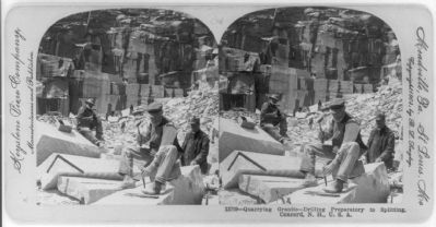
A line of holes was drilled where the stone was to be split. The holes were filled with two shoe horn-shaped pieces of iron called feathers. Wedges were hammered between the feathers and they directed force outward from the line of holes. The feathers could be wiggled to even the pressure and assure a straight split. It may have taken hours to cut one piece of stone!
Quarries were a big business in Richmond in the 19th and early 20th centuries. The city’s location on the Fall Line yielded an abundance of granite. Slaves often did the work so quarries struggled to find labor after the Civil War. The cut stone industry eventually gave way to concrete and steel construction.
Look for granite streets and sidewalks in the Shockoe Slip neighborhood of Richmond. Stone from these quarries was used extensively along Cary Street and the side streets.
(captions)
(bottom left) This Victorian stereocard shows the painstaking process of drilling holes in granite to prepare it for splitting. Image courtesy of the Library of Congress
(top right) This map shows the extent of the granite industry along the south bank of the James River in the nineteenth century. The current locations of the Powhite Parkway and Pony Pasture Rapids Park have been added. Image courtesy of the Library of Virginia and Kane Design
Erected by Southampton Citizen’s Association, James River Park System (Department of Parks, Recreation and Community Facilities).
Topics. This historical marker is listed in this topic list: Industry & Commerce.
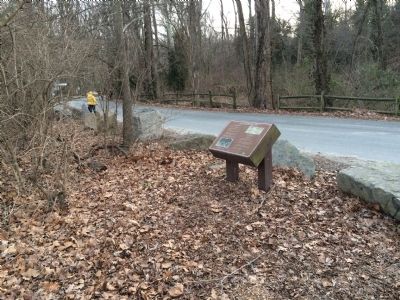
Location. 37° 33.11′ N, 77° 31.313′ W. Marker is in Richmond, Virginia. It is in Stratford Hills. Marker is on Riverside Drive, 0.1 miles north of Rockfalls Drive, on the right when traveling west. Touch for map. Marker is at or near this postal address: 7343 Riverside Drive, Richmond VA 23225, United States of America. Touch for directions.
Other nearby markers. At least 8 other markers are within 2 miles of this marker, measured as the crow flies. Pony Pasture Rapids (about 400 feet away, measured in a direct line); Wilton (approx. ¾ mile away); Windsor (approx. 1.1 miles away); a different marker also named Wilton (approx. 1.2 miles away); Ampthill (approx. 1.2 miles away); Richmond Defences (approx. 1.2 miles away); Three-Chopt Road (approx. 1.2 miles away); Intermediate Line of Confederate Defenses (approx. 1.3 miles away). Touch for a list and map of all markers in Richmond.
Credits. This page was last revised on February 1, 2023. It was originally submitted on February 15, 2015, by J. Makali Bruton of Accra, Ghana. This page has been viewed 667 times since then and 65 times this year. Photos: 1, 2. submitted on February 15, 2015, by J. Makali Bruton of Accra, Ghana. 3. submitted on February 16, 2015. • Bernard Fisher was the editor who published this page.


