Rothenburg ob der Tauber in Ansbach, Bavaria, Germany — Central Europe
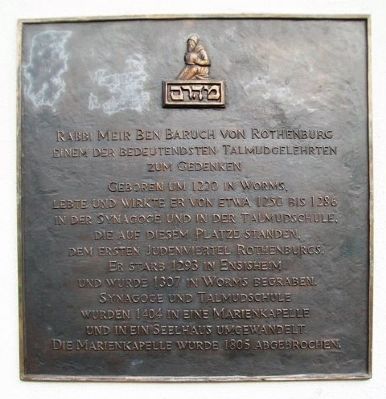
Rabbi Meir ben Baruch von Rothenburg
Inscription.
Geboren um 1220 in Worms,
lebte und wirkte er von etwa 1250 bis 1286 in der Synagoge und in der Talmudschule,
die auf diesem Platze standen, dem ersten Judenviertel Rothenburgs.
Er starb 1293 in Ensisheim und wurde 1307 in Worms begraben.
Synagoge und Talmudschule wurden 1404 in eine Marienkapelle und in ein Seelhaus ungewandelt.
Die Marienkapelle wurde 1805 abgebrochen.
————————
Commemorating Rabbi Meir ben Baruch of Rothenburg, one of the greatest Talmudic scholars
Born in 1220 in Worms,
he lived and worked from about 1250 to 1286 in the Synagogue and in the Yeshiva,
which stood on this spot, the first Rothenburg Jewish Quarter.
He died in 1293 in Ensisheim and was buried in 1307 in Worms.
Synagogue and Yeshiva were converted into a Lady Chapel and into a hospice and hostel in 1404.
The Lady Chapel was closed in 1805.
Topics. This historical marker is listed in these topic lists: Churches & Religion • Education • Government & Politics • Man-Made Features. A significant historical year for this entry is 1220.
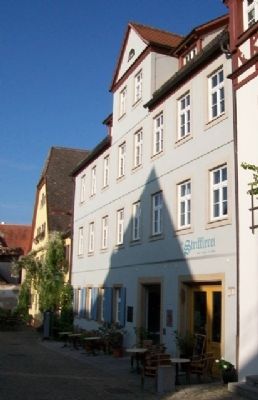
Location. 49° 22.671′ N, 10° 10.806′ E. Marker is in Rothenburg ob der Tauber, Bayern (Bavaria), in Ansbach. Marker is on Kapellenplatz just west of Marktmilch, on the right when traveling west. Touch for map. Marker is at or near this postal address: Kapellenplatz 5, Rothenburg ob der Tauber BY 91541, Germany. Touch for directions.
Other nearby markers. At least 8 other markers are within walking distance of this marker. Christian I (about 90 meters away, measured in a direct line); Büttelhaus / Bailiff's House (about 120 meters away); St.-Michaels-Kapelle Rothenburg ob der Tauber / St Michaels Chapel (about 120 meters away); Jews's Alley and Jewish Quarter (about 120 meters away); Neues Rathaus / New Town Hall (about 120 meters away); Heinr. Toppler (about 150 meters away); Fleischhaus / Meat House (about 150 meters away); Altes Rathaus / Old Town Hall (about 150 meters away). Touch for a list and map of all markers in Rothenburg ob der Tauber.
Also see . . .
1. Rothenburg History. Rothenburg ob der Tauber website entry (Submitted on October 2, 2014, by William Fischer, Jr. of Scranton, Pennsylvania.)
2. Maharam of Rothenburg. Chabad website entry (Submitted on October 2, 2014, by William Fischer, Jr. of Scranton, Pennsylvania.)
Additional keywords. Gedenktafel
Credits. This page was last revised on February 19, 2024. It was originally submitted on October 1, 2014, by William Fischer, Jr. of Scranton, Pennsylvania. This page has been viewed 682 times since then and 12 times this year. Last updated on February 16, 2015, by J. Makali Bruton of Accra, Ghana. Photos: 1, 2. submitted on October 2, 2014, by William Fischer, Jr. of Scranton, Pennsylvania. • Bill Pfingsten was the editor who published this page.

