King's Reach Post Mold Patterns
King’s Reach Site
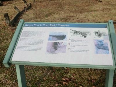
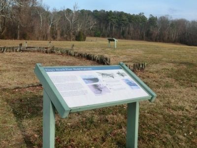
At King’s Reach, the post mold shapes tell archaeologists that the house builders placed each post in a pre-dug hole. The orientation of the holes, and the way the posts were set in them, indicate that the walls of the house were preassembled and then erected. This was a common practice at colonial sites in the Chesapeake Bay region.
Other buildings at his plantation were constructed around closely-spaced posts that were struck in trenches, rather than into individual holes. This construction technique is not seen often on sites dating to the late 1600s.
(Inscription under the images in the center)
Closeup of partially decayed cedar post from the tobacco barn site.
Step 1 Rectangular-shaped holes are dug approximately 3 feet wide and nearly as deep.
Step 2 The posts are placed in the holes at a low angle.
Step3 The pre-assembled wall is tilted up and loose dirt is back-filled in the void
Topics. This historical marker is listed in these topic lists: Colonial Era
Location. 38° 24.12′ N, 76° 30.714′ W. Marker is in St. Leonard, Maryland, in Calvert County. Marker is on Jefferson Patterson Park Road. The marker is on the grounds of the Jefferson Patterson Park and Museum. Touch for map. Marker is in this post office area: Saint Leonard MD 20685, United States of America. Touch for directions.
Other nearby markers. At least 8 other markers are within walking distance of this marker. What Life Was Like Here (here, next to this marker); Evidence Found in the Ground (here, next to this marker); Excavation Process Gathers the Most Information (within shouting distance of this marker); Indian Life at the Stearns Site (about 400 feet away, measured in a direct line); War on the Water (about 500 feet away); Discovery of a Colonial Plantation (about 700 feet away); Jefferson Patterson Park & Museum (approx. ¼ mile away); a different marker also named Jefferson Patterson Park & Museum (approx. 0.3 miles away). Touch for a list and map of all markers in St. Leonard.
Credits. This page was last revised on June 16, 2016. It was originally submitted on February 18, 2015, by Don Morfe of Baltimore, Maryland. This page has been viewed 303 times since then and 9 times this year. Photos: 1, 2, 3. submitted on February 18, 2015, by Don Morfe of Baltimore, Maryland. • Bill Pfingsten was the editor who published this page.


