Wamego in Pottawatomie County, Kansas — The American Midwest (Upper Plains)
Sand and Quartz Boulder
Photographed by William Fischer, Jr., May 18, 2012
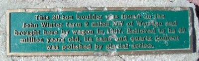
1. Sand and Quartz Boulder Marker
This 20-ton boulder was found on the John Winter farm 9 miles NW of Wamego and brought here by wagon in 1907. Believed to be 40 million years old, its sand and quartz content were polished by glacial action.
Erected by City of Wamego.
Topics. This historical marker is listed in this topic list: Environment. A significant historical year for this entry is 1907.
Location. 39° 12.156′ N, 96° 18.136′ W. Marker is in Wamego, Kansas, in Pottawatomie County. It can be reached from 6th Street. Marker and boulder are in the City Park. Touch for map. Marker is at or near this postal address: 500 Ash Street, Wamego KS 66547, United States of America. Touch for directions.

Regionally, this marker is in Eastern Kansas and specifically in Bleeding Kansas Border War Country. It is also in the American Midwest, in the Corn Belt, on the prairies, and on the Southern Plains. Globally, it is in North America, the Western Hemisphere, the Western World, and the Anglosphere. Historically, it finds itself in what was once the Louisiana Purchase.
Other nearby markers. At least 8 other markers are within 5 miles of this marker,
this page online
Also see . . .
1. Wamego City Park. City website entry (Submitted on February 18, 2015, by William Fischer, Jr. of Reynoldsburg, Ohio.)
2. Glaciers in Kansas. Kansas Geological Survey website entry (Submitted on February 18, 2015, by William Fischer, Jr. of Reynoldsburg, Ohio.)
3. Glaciation. Encyclopedia of the Great Plains website entry (Submitted on February 18, 2015, by William Fischer, Jr. of Reynoldsburg, Ohio.)
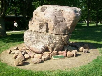
Photographed by William Fischer, Jr., May 18, 2012
2. Sand and Quartz Boulder and Marker
Credits. This page was last revised on April 4, 2025. It was originally submitted on February 18, 2015, by William Fischer, Jr. of Reynoldsburg, Ohio. This page has been viewed 630 times since then and 18 times this year. Photos: 1, 2. submitted on February 18, 2015, by William Fischer, Jr. of Reynoldsburg, Ohio.
