Excavation Process Gathers the Most Information
Kings Reach Site
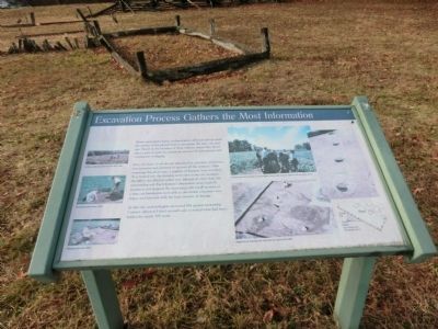
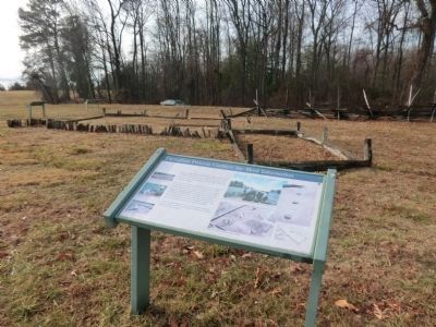
First, the layer of soil already disturbed by centuries of plowing was removed and screened to recover all the artifacts. After removing the plow zone, a number of features were revealed. To a trained eye, the features were easy to see; for example, the soil in the filled-in cellars was different in color than the surrounding soil. Each feature’s dimensions were carefully measured and mapped. By excavating only small sections at a time, archaeologists were able to determine a feature’s size, shape, and function with least amount of damage.
At this site, archaeologist excavated 1434 squares measuring 2 meters (about 6.5 feet) on each side to reveal what had been hidden for nearly 300 years.
(Inscription on the three images on the left)
Surface collecting objects in the field, 1984. Excavating plow zone, 1998. Mapping the site, 1998.
(Inscription on
this page online
Professional and volunteer archaeologist screen and remove objects from the plow zone. King’s Reach features are indicated by darker soil, 1984.
Topics. This historical marker is listed in these topic lists: Colonial Era • Settlements & Settlers. A significant historical year for this entry is 1434.
Location. 38° 24.123′ N, 76° 30.697′ W. Marker is in St. Leonard, Maryland, in Calvert County. It is on Jefferson Patterson Park Road. The marker is located on the grounds of the Jefferson Patterson Park and Museum. Touch for map. Marker is in this post office area: Saint Leonard MD 20685, United States of America. Touch for directions.

Regionally, this marker is in Southern Maryland. It is also in the American South, specifically in the Upper South, in the Mid-Atlantic, in the Tidewater, in the Chesapeake Bay Region, and on the Eastern Seaboard. Globally, it is in the North Atlantic Region, North America, the Western Hemisphere, the Western World, and the Anglosphere. Historically, it finds itself in what was once one of the original Thirteen Colonies and also the Antebellum South.
Other nearby markers. At
Credits. This page was last revised on June 16, 2016. It was originally submitted on February 19, 2015, by Don Morfe of Baltimore, Maryland. This page has been viewed 490 times since then and 20 times this year. Photos: 1, 2, 3, 4. submitted on February 19, 2015, by Don Morfe of Baltimore, Maryland. • Bill Pfingsten was the editor who published this page.
