Route of the Oregon Trail
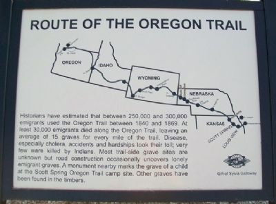
Historians have estimated that between 250,000 and 300,000 emigrants used the Oregon Trail between 1840 and 1869. At least 30,000 emigrants died along the Oregon Trail, leaving an average of 15 graves for every mile of the trail. Disease, especially cholera, accidents and hardships took their toll; very few were killed by Indians. Most trail-side grave sites are unknown but road construction occasionally uncovers lonely emigrant graves. A monument nearby marks the grave of a child at the Scott Spring Oregon Trail camp site. Other graves have been found in the timbers.
Erected by Sylvia Galloway.
Topics and series. This historical marker is listed in these topic lists: Roads & Vehicles • Settlements & Settlers. In addition, it is included in the Oregon Trail series list. A significant historical year for this entry is 1840.
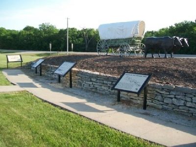
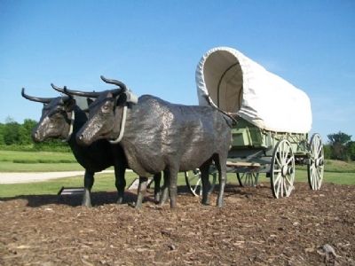
Location. 39° 22.997′ N, 96° 24.352′ W. Marker is near Westmoreland, Kansas, in Pottawatomie County. It is on The Road to Oz Highway (State Highway 99), on the left when traveling south. Marker is next to the covered wagon in Oregon Trail Park. Touch for map. Marker is in this post office area:
this page online

Regionally, this marker is in Eastern Kansas and specifically in Bleeding Kansas Border War Country. It is also in the American Midwest, in the Corn Belt, on the prairies, and on the Southern Plains. Globally, it is in North America, the Western Hemisphere, the Western World, and the Anglosphere. Historically, it finds itself in what was once the Louisiana Purchase.
Other nearby markers. At least 8 other markers are within walking distance of this marker: The Wagon & Team • Supplies Needed (here, next to this marker); One Step at a Time (here, next to this marker); The Long Journey (a few steps from this marker); Archeological Site 14-PO1311 (within shouting distance of this marker); Tallgrass Prairie (within shouting distance of this marker); Wagons Fording Rock Creek (about 300 feet away, measured in a direct line); Scott Spring (about 300 feet away); Burial Site of Oregon Trail Traveler (about 300 feet away). Touch for a list and map of all markers in Westmoreland.
Also see . . .
1. Oregon National Historic Trail. (Submitted on February 20, 2015, by William Fischer, Jr. of Reynoldsburg, Ohio.)
2. Oregon-California Trails Association.
3. National Frontier Trails Museum. National Park Service website entry (Submitted on May 4, 2026, by Larry Gertner of New York, New York.)
4. National Oregon/California Trail Center at Montpelier, Idaho. (Submitted on February 20, 2015, by William Fischer, Jr. of Reynoldsburg, Ohio.)
Credits. This page was last revised on May 4, 2026. It was originally submitted on February 20, 2015, by William Fischer, Jr. of Reynoldsburg, Ohio. This page has been viewed 1,074 times since then and 64 times this year. Photos: 1, 2. submitted on February 20, 2015, by William Fischer, Jr. of Reynoldsburg, Ohio. 3. submitted on February 19, 2015, by William Fischer, Jr. of Reynoldsburg, Ohio. 4. submitted on February 20, 2015, by William Fischer, Jr. of Reynoldsburg, Ohio.
