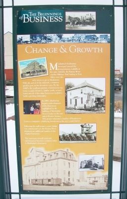
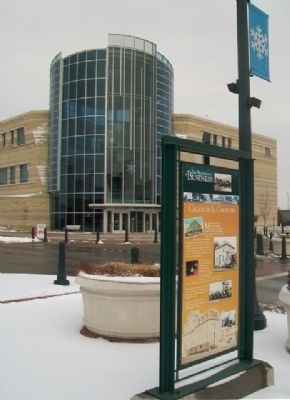
Change & Growth
The Beginnings of Business

Click for more information.
Manhattan's businesses developed around the transportation available at the time. Initially, the Kansas River and the Military Trail leading to Fort Riley were the only routes to get to Manhattan. With the arrival of the railroads, commerce quickly grew in the downtown area. By the 1880's, the southeast portion of downtown was home to grain elevators, lumber yards, several hotels and all of the other businesses needed to build a growing community.
In 1987, Manhattan began a redevelopment of the downtown highlighted by the building of Manhattan Town Center on the east end of Poyntz Avenue. This project relocated a number of business-to-business companies, solidifying downtown as the city's retail district.
Following the mall project, a new bridge was constructed over the Kansas River displacing an additional number of the original businesses.
The movement toward retail and entertainment business continues today in Manhattan's downtown.
Credits: Photos - Riley County Historical Society
Topics. This historical marker is listed in these topic lists: Industry & Commerce • Railroads & Streetcars • Settlements & Settlers • Waterways & Vessels. A significant historical year for this entry is 1987.
Location. 39° 10.564′ N, 96° 33.621′ W. Marker is in Manhattan
Other nearby markers. At least 8 other markers are within walking distance of this marker. Manhattan's Union Pacific Depot - Revived (about 300 feet away, measured in a direct line); Colorado Street (about 500 feet away); Yuma Street (about 600 feet away); The American Veteran (approx. ¼ mile away); Riley County Courthouse (approx. 0.3 miles away); Carnegie Library (approx. 0.3 miles away); Amanda Arnold Arch (approx. 0.3 miles away); Damon Runyon (approx. 0.4 miles away). Touch for a list and map of all markers in Manhattan.
Also see . . . Manhattan, Kansas. Wikipedia entry (Submitted on February 22, 2015, by William Fischer, Jr. of Scranton, Pennsylvania.)
Credits. This page was last revised on April 12, 2022. It was originally submitted on February 22, 2015, by William Fischer, Jr. of Scranton, Pennsylvania. This page has been viewed 476 times since then and 15 times this year. Photos: 1, 2. submitted on February 22, 2015, by William Fischer, Jr. of Scranton, Pennsylvania.
