Near Wakefield in Clay County, Kansas — The American Midwest (Upper Plains)
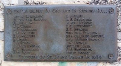
Founders of St. John's Parish in 1874
To The Glory of God and In Memory of ...
Photographed by William Fischer, Jr., February 16, 2015
1. Founders of St. John's Parish in 1874 Marker
Rev. W. H. Hickcox • Dr. Charles Hewitt • Frank Lewin • W. A. Willis • J. P. Marshall • H. S. Walters • E. F. Walters • B. Adams • T. C. Ruscoe • Charles Ingram • R. T. Batchalor • E. M. Davis • R. Fowles • A. B. Rothwell • James H. Young • T. N. Pettigrew • E. T. Buckell • Mrs. M. L. Pearson • Mrs. Charles Moultrie • Rev. Alfred Brown • I. W. Thomas • Edward Jones • F. D. Broughton • Philip Pocock
Topics. This historical marker is listed in these topic lists: Cemeteries & Burial Sites • Religion & Religious Structures.
Location. 39° 13.174′ N, 97° 4.47′ W. Marker is near Wakefield, Kansas, in Clay County. It is at the intersection of 7th Road (State Highway 82) and 839th Road, on the left when traveling west on 7th Road. The cemetery is about three miles west of Wakefield. Touch for map. Marker is in this post office area: Wakefield KS 67487, United States of America. Touch for directions.

Regionally, this marker is in the American Midwest, in the Corn Belt, on the prairies, and on the Southern Plains. Globally, it is in North America, the Western Hemisphere,
this page online
Other nearby markers. At least 6 other markers are within 12 miles of this marker, measured as the crow flies: St. John's Episcopal Church (within shouting distance of this marker); Better Homes & Gardens' Highest Community Honor (approx. 11 miles away); Clay Center Municipal Band Shell (approx. 11 miles away); M60 Tank (approx. 11.1 miles away); Civil War Memorial (approx. 11.2 miles away); Clay County Veterans Memorial (approx. 11.2 miles away).
Related marker. Click here for another marker that is related to this marker.
Photographed by William Fischer, Jr., February 16, 2015
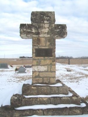
2. Founders of St. John's Parish in 1874 Marker on Cross
Photographed by William Fischer, Jr.
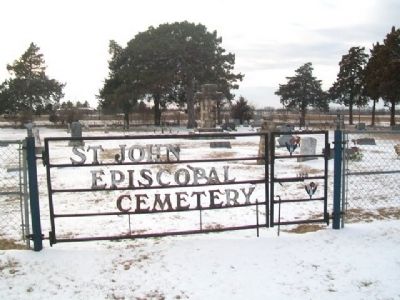
3. St. John's Episcopal Cemetery
Photographed by William Fischer, Jr., February 16, 2015
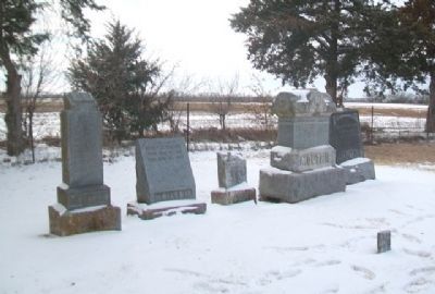
4. Moultrie Family Plot in St. John's Episcopal Cemetery
Credits. This page was last revised on September 19, 2024. It was originally submitted on February 23, 2015, by William Fischer, Jr. of Reynoldsburg, Ohio. This page has been viewed 531 times since then and 17 times this year. Photos: 1, 2. submitted on February 23, 2015, by William Fischer, Jr. of Reynoldsburg, Ohio. 3. submitted on February 22, 2015, by William Fischer, Jr. of Reynoldsburg, Ohio. 4. submitted on February 23, 2015, by William Fischer, Jr. of Reynoldsburg, Ohio.
