Marker Logo HMdb.org THE HISTORICAL
MARKER DATABASE
“Bite-Size Bits of Local, National, and Global History”
Near Reynolds in Taylor County, Georgia — The American South (South Atlantic)
 

Gen. John B. Gordon Marker


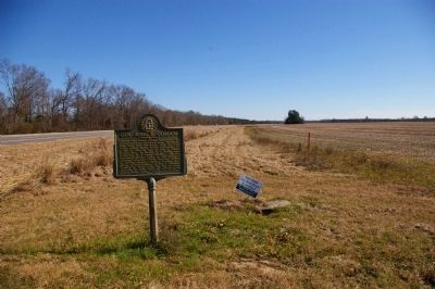
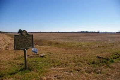
Gen. John B. Gordon Marker image. Click for full size.
Photographed By David Seibert, January 18, 2010
1. Gen. John B. Gordon Marker
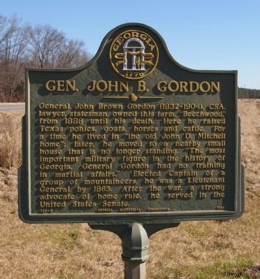
Inscription. General John Brown Gordon (1832-1904), CSA, lawyer, statesman, owned this farm, “Beechwood,” from 1888 until his death. Here he raised Texas ponies, goats, horses and cattle. For a time he lived in “the old John D. Mitchell home”; later, he moved to a nearby small house that is no longer standing. “The most important military figure in the history of Georgia, General Gordon had no training in martial affairs.” Elected Captain of a group of mountaineers, he was a Lieutenant General by 1865. After the war, a strong advocate of home rule, he served in the United States Senate.
 
Erected 1958 by Georgia Historical Commission. (Marker Number 133-5.)
 
Topics and series. This historical marker is listed in these topic lists: Government & PoliticsWar, US Civil. In addition, it is included in the Georgia Historical Society series list. A significant historical year for this entry is 1888.
 
Location. Marker has been reported missing. It was located near 32° 33.45′ N, 84° 4.245′ W. Marker was near Reynolds, Georgia, in Taylor County. Marker could be reached from the intersection of Marion Street (Georgia Route 96/540) and South Gen. John B. Gordon Road (County Road 269), on the right when traveling east
Paid Advertisement
Click on the ad for more information.
Please report objectionable advertising to the Editor.
Click or scan to see
this page online
. Touch for map. Marker was at or near this postal address: 4416 Marion St, Reynolds GA 31076, United States of America. Touch for directions.
 
Other nearby markers. At least 8 other markers are within 10 miles of this location, measured as the crow flies. Fort Lawrence (approx. 7.8 miles away); Taylor County Rural Electric Cooperative (approx. 8 miles away); Creek Agency (approx. 8.1 miles away); The Wire Road (approx. 9.1 miles away); William Bartram Trail (approx. 9.1 miles away); Taylor County War Memorial (approx. 9.7 miles away); Confederate Memorial (approx. 9.7 miles away); Taylor County (approx. 9.7 miles away). Touch for a list and map of all markers in Reynolds.
 
Also see . . .  John B. Gordon. A detailed Wikipedia biography. (Submitted on February 4, 2010, by David Seibert of Sandy Springs, Georgia.) 
 
Gen. John B. Gordon Marker image. Click for full size.
Photographed By David Seibert, January 18, 2010
2. Gen. John B. Gordon Marker
The John B. Gordon farm today
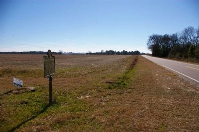
Gen. John B. Gordon Marker image. Click for full size.
Photographed By David Seibert, January 18, 2010
3. Gen. John B. Gordon Marker
Looking east, on Georgia Highway 96
Gen. John B. Gordon Marker image. Click for full size.
Photographed By David Seibert, January 18, 2010
4. Gen. John B. Gordon Marker
Looking south on South General John B. Gordon Road, past the site of his farm
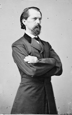
Gen. John Brown Gordon image. Click for full size.
Photographed By Matthew Brady, 1865
5. Gen. John Brown Gordon
The photo, from the Library of Congress, is provided by Wikipedia Commons.
 
 
Credits. This page was last revised on April 4, 2024. It was originally submitted on February 4, 2010, by David Seibert of Sandy Springs, Georgia. This page has been viewed 2,277 times since then and 75 times this year. Last updated on April 4, 2024, by Larry Vogel of Acworth, Georgia. Photos:   1, 2, 3, 4, 5. submitted on February 4, 2010, by David Seibert of Sandy Springs, Georgia. • Devry Becker Jones was the editor who published this page.
Share this page.  
Share on Tumblr
m=244274

CeraNet Cloud Computing sponsors the Historical Marker Database.
This website earns income from purchases you make after using our links to Amazon.com. We appreciate your support.
Paid Advertisement
Apr. 25, 2024