Near Solomons in Calvert County, Maryland — The American Northeast (Mid-Atlantic)
Menace on the Horizon
Star-Spangled Banner National Historical Trail
| — | National Park Service, U.S. Department of the Interior | — |
Photographed by Don Morfe, February 10, 2015
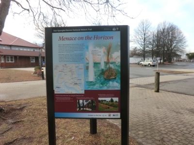
1. Menace on the Horizon Marker
Terror reigned along the Patuxent River in 1814. British invaders plundered and burned towns and plantations on both sides of the river. Menacing warships within view on Somervell’s Island (present-day Solomons) blockaded the river’s mouth, cutting off trade and trapping Commodore Joshua Barney’s Chesapeake Flotilla.
British attacks continued “like drum beats up and down the river” throughout the summer. In August the British commander reported: this “country is in general in a horrible state.” With little more effort the Americans could be “completely at our mercy.” The British pressed their offensive up the Patuxent toward Washington, D. C.
"…the people on… the Patuxent are in the greatest alarm…"
- British Captain Joseph Nourse, July 23, 1814
To learn more about the war along the Patuxent visit:
✶ Exhibit hall here at Calvert Marine Museum - Interactive map depicting the British invasion route, artifacts from the scuttled American flotilla.
✶ Tudor Hall - Wayside and interior War of 1812 exhibits.
✶ Jefferson Patterson Park and Museum - Exhibits, site of largest naval engagementin Maryland history.
Click or scan to see
this page online
✶ Sotterley Plantation - Restored 18th century plantation and slave quarter; period gardens; a mustering site for militia during the war.
Erected by National Park Service, U.S. Department of the Interior.
Topics and series. This historical marker is listed in these topic lists: War of 1812 • Waterways & Vessels. In addition, it is included in the Star-Spangled Banner National Historic Trail series list. A significant historical date for this entry is July 23, 1814.
Location. 38° 19.893′ N, 76° 27.845′ W. Marker is near Solomons, Maryland, in Calvert County. It can be reached from Solomons Island Road South (Route 2) just south of Thomas Johnson Road, on the left when traveling south. The marker is on the grounds of the Calvert Marine Museum in front of the main exhibition hall. Touch for map. Marker is at or near this postal address: 14200 Solomons Island Road South, Solomons MD 20688, United States of America. Touch for directions.

Regionally, this marker is in Southern Maryland. It is also in the American South, specifically in the Upper South, in the Mid-Atlantic, in the Tidewater, in the Chesapeake

Other nearby markers. At least 8 other markers are within walking distance of this marker: "O! say can you see…" (here, next to this marker); War in the Chesapeake (here, next to this marker); Marine Railway Gears (here, next to this marker); Chaney Rail Skiff (here, next to this marker); Whittington Rail Skiff (here, next to this marker); Yawl Boat (a few steps from this marker); Crab Skiff Pep (Reproduction) (a few steps from this marker); Hooper Island Launch Penguin (a few steps from this marker). Touch for a list and map of all markers in Solomons.
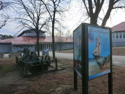
Photographed by Don Morfe, February 10, 2015
3. Side panel on the Menace on the Horizon Marker
The Main Exhibition Hall of the Calvert Maritime Museum is in the background
Credits. This page was last revised on November 2, 2025. It was originally submitted on February 26, 2015, by Don Morfe of Baltimore, Maryland. This page has been viewed 556 times since then and 17 times this year. Photos: 1. submitted on February 26, 2015, by Don Morfe of Baltimore, Maryland. 2. submitted on November 2, 2025, by Devry Becker Jones of Washington, District of Columbia. 3. submitted on February 26, 2015, by Don Morfe of Baltimore, Maryland. • Bill Pfingsten was the editor who published this page.
