Montross in Westmoreland County, Virginia — The American South (Mid-Atlantic)
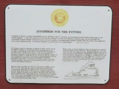
Dividends for the Future
Civilian Conservation Corps 1933-1942
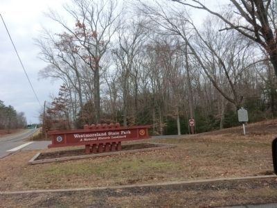
— Westmoreland State Park —
“I propose to create a civilian conservation corps…confining itself to forestry, the prevention of soil erosion, flood control, and similar projects. I call your attention to the fact that this type of work is of definite, practical value, not only through the prevention of great present financial loss, but also as a means of creating future national wealth…This enterprise is an established part of our national policy. It will pay dividends to present and future generations…” President Franklin D. Roosevelt, 1933
With these words to Congress in March of 1933, newly elected President Franklin D. Roosevelt laid the cornerstone of the Civilian Conservation Corps (CCC), one of the key elements of the “New Deal”. At the time, America was in the midst of a deepening national crisis, brought on by the financial collapse of the stock market in 1929. Thousands of business was failing and millions of Americans were unemployed. President Roosevelt’s “New Deal” consisted of a series of new, federally funded programs designed to put America back to work and rebuild the national economy.
Between 1933 and 1942, the CCC put over three million young men to work restoring the nation’s natural resources and constructing park and recreation areas. Virginia benefited greatly from their efforts. The first six Virginia State Parks—Hungry Mother, Douthat, Fairy Stone, Westmoreland, Staunton River and Seashore—were built by the men of the CCC. Another CCC-built project, The Swift Creek Recreation Demonstration Area, was eventually deeded to the state by the federal government and became Pocahontas State Park.
Many of the original structures here in the park are marked with the bright yellow CCC logo. We hope that you will take time to notice and appreciate the wonderful legacy left by the men and boys of the Civilian Conservation Corps. Whether it is the handsome stonework on a bridge or retaining wall, the large, hand-forged hinges on a log cabin door, or one of the impressive log and stone picnic shelters, the craftsmanship and attention to detail that became the hallmark of CCC construction is evident.
Topics and series. This historical marker is listed in these topic lists: Charity & Public Work • Man-Made Features. In addition, it is included in the Civilian Conservation Corps (CCC), and the Former U.S. Presidents: #32 Franklin D. Roosevelt series lists. A significant historical month for this entry is March 1933.
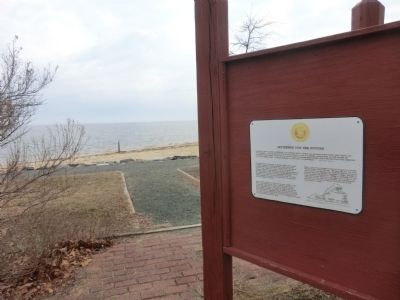
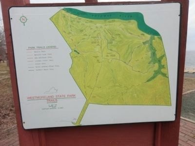
Location. 38° 10.384′ N, 76° 52.632′ W. Marker is in Montross, Virginia, in Westmoreland County. Marker can be reached from State Park Road (Virginia Route 347) half a mile north of Virginia Route 686. Located at the riverside picnic area in Westmoreland State Park. Touch for map. Marker is at or near this postal address: 1650 State Park Road, Montross VA 22520, United States of America. Touch for directions.
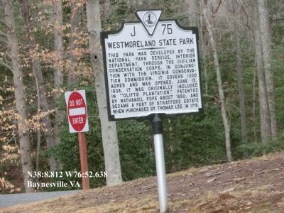
Other nearby markers. At least 8 other markers are within 3 miles of this marker, measured as the crow flies. Putting the Potomac on the Map (within shouting distance of this marker); Tempting Target (approx. ¾ mile away); War in the Chesapeake (approx. ¾ mile away); A Testament to Craftsmanship (approx. 0.9 miles away); Westmoreland State Park (approx. 1.8 miles away); Stratford and Chantilly (approx. 2.2 miles away); Artery of Commerce (approx. 2.3 miles away); Popes Creek Plantation (approx. 2.3 miles away). Touch for a list and map of all markers in Montross.
Also see . . . Westmoreland State Park. Virginia Department of Conservation & Recreation (Submitted on March 5, 2015.)
Credits. This page was last revised on June 16, 2016. It was originally submitted on March 4, 2015, by Don Morfe of Baltimore, Maryland. This page has been viewed 300 times since then and 9 times this year. Photos: 1, 2, 3, 4, 5. submitted on March 4, 2015, by Don Morfe of Baltimore, Maryland. • Bernard Fisher was the editor who published this page.
