Bluffton in Wells County, Indiana — The American Midwest (Great Lakes)
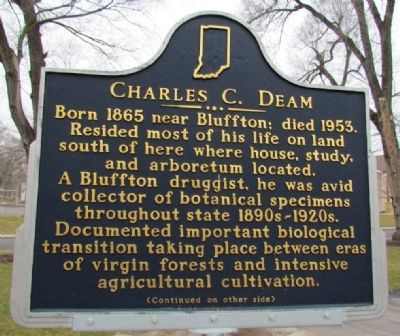
Charles C. Deam
Photographed by Duane Hall, March 16, 2013
1. Charles C. Deam Marker (Front)
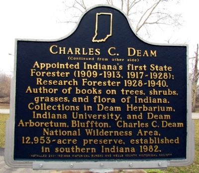
Appointed Indiana's first State Forester (1909-1913, 1917-1928); Research Forester 1928-1940. Author of books on trees, shrubs, grasses, and flora of Indiana. Collections in Deam Herbarium, Indiana University, and Deam Arboretum, Bluffton. Charles C. Deam National Wilderness Area, 12,953-acre preserve, established in southern Indiana 1982.
Erected 2001 by Indiana Historical Bureau and Wells County Historical Society. (Marker Number 90.2001.1.)
Topics and series. This historical marker is listed in these topic lists: Education • Horticulture & Forestry • Science & Medicine. In addition, it is included in the Indiana Historical Bureau Markers series list. A significant historical year for this entry is 1865.
Location. 40° 44.33′ N, 85° 9.919′ W. Marker is
this page online

Regionally, this marker is in Greater Fort Wayne. It is also in the American Midwest and in the Corn Belt. Globally, it is in North America, the Western Hemisphere, the Western World, and the Anglosphere. Historically, it finds itself in what was once the territory of the Mississippian Culture and also the Northwest Territory.
Other nearby markers. At least 8 other markers are within walking distance of this marker: Pickett's Run (about 400 feet away, measured in a direct line); Bluffton Mill Race (approx. ¼ mile away); Wells County Courthouse (approx. 0.3 miles away); Sgt. William Bumparner (approx. 0.3 miles away); Wells County 1862 Cannon - Civil War (approx. 0.3 miles away); Wells County War on Terrorism Honor Roll (approx. half a mile away); Wells County Veterans Honor Roll (approx. half a mile away);
Photographed by Duane Hall, March 16, 2013
2. Charles C. Deam Marker (Back)
Related marker. Click here for another marker that is related to this marker. Nearby marker on the Deam Oak.
Photographed by Duane Hall, March 16, 2013
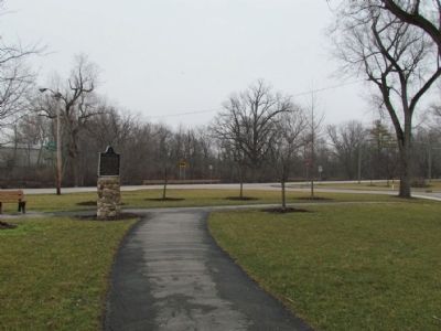
3. East End of Pickett's Run Park
Credits. This page was last revised on November 19, 2019. It was originally submitted on March 18, 2013, by Duane Hall of Abilene, Texas. This page has been viewed 825 times since then and 29 times this year. Last updated on March 6, 2015, by J. Makali Bruton of Washington, District of Columbia. Photos: 1, 2, 3. submitted on March 18, 2013, by Duane Hall of Abilene, Texas. • Bill Pfingsten was the editor who published this page.
