Montcalm in Québec in Capitale-Nationale, — Central Canada (French-Canadian)
The “Louisbourg Grenadiers”
Les grenadiers de Louisbourg
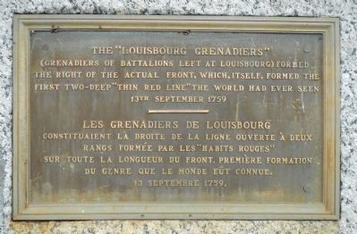
Photographed by Barry Swackhamer, July 25, 2014
1. The “Louisbourg Grenadiers” Marker
French:
Erected by National Battlefields Commission / Commission des champs de bataille nationaux.
Topics. This historical marker is listed in this topic list: War, French and Indian. A significant historical date for this entry is September 13, 1759.
Location. 46° 48.035′ N, 71° 13.249′ W. Marker is in Québec, in Capitale-Nationale. It is in Montcalm. It is on Rue Garneau. Touch for map. Marker is at or near this postal address: Rue Garneau, Québec G1R 2L3, Canada. Touch for directions.

Regionally, this marker is in Central Canada. Globally, it is in North America, the Western Hemisphere, and the Western World. Historically, it finds itself in what was once a British colony, the Viceroyalty of New France,
this page online
Other nearby markers. At least 8 other markers are within walking distance of this marker: Here, on the very eve of victory (within shouting distance of this marker); Quebec City Astronomical Observatory (about 90 meters away, measured in a direct line); The / Le Royal Roussillon, (about 90 meters away); Bragg’s 28th Foot, (about 90 meters away); Frederick G. Todd (about 210 meters away); Pavillon Charles-Baillairgé (approx. 0.3 kilometers away); Cornelius Krieghoff (approx. 0.3 kilometers away); Montcalm (approx. 0.3 kilometers away). Touch for a list and map of all markers in Québec.
More about this marker. This marker is located near the Edwin-Bélanger Bandstand in National Battlefields Park.
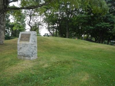
Photographed by Barry Swackhamer, July 25, 2014
2. The “Louisbourg Grenadiers” Marker
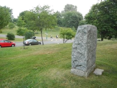
Photographed by Barry Swackhamer, July 25, 2014
3. The “Louisbourg Grenadiers” Marker
Credits. This page was last revised on February 9, 2023. It was originally submitted on March 6, 2015, by Barry Swackhamer of Brentwood, California. This page has been viewed 579 times since then and 35 times this year. Photos: 1, 2, 3. submitted on March 6, 2015, by Barry Swackhamer of Brentwood, California. • Andrew Ruppenstein was the editor who published this page.
