Marker Logo HMdb.org THE HISTORICAL
MARKER DATABASE
“Bite-Size Bits of Local, National, and Global History”
Jonesborough in Washington County, Tennessee — The American South (East South Central)
 

Cherokee Church

Holston Baptist Association

— 0.1 mile —


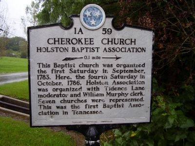
Cherokee Church Marker image. Click for full size.
Photographed By Stanley and Terrie Howard, September 26, 2009
1. Cherokee Church Marker
Inscription. This Baptist church was organized the first Saturday in September, 1783. Here, the fourth Saturday in October, 1786, Holston Association was organized with Tidence Lane moderator and William Murphy clerk. Seven churches were represented. This was the first Baptist Association in Tennessee.
 
Erected by Tennessee Historical Commission. (Marker Number 1A 59.)
 
Topics and series. This historical marker is listed in these topic lists: Cemeteries & Burial SitesChurches & ReligionSettlements & Settlers. In addition, it is included in the Tennessee Historical Commission series list. A significant historical month for this entry is September 1783.
 
Location. 36° 14.154′ N, 82° 27.77′ W. Marker is in Jonesborough, Tennessee, in Washington County. Marker is at the intersection of Mayberrry Road and Highway 81 on Mayberrry Road. Touch for map. Marker is in this post office area: Jonesborough TN 37659, United States of America. Touch for directions.
 
Other nearby markers. At least 8 other markers are within 4 miles of this marker, measured as the crow flies. Old Dutch Meeting House (within shouting distance of this marker); Jacob Brown (approx. 2 miles away); Keystone Pottery (approx. 3 miles away); The Tester Brothers (approx. 3.1 miles away); Alfred Martin Ray Buffalo Soldier (approx. 3.9 miles
Paid Advertisement
Click on the ad for more information.
Please report objectionable advertising to the Editor.
Click or scan to see
this page online
away); First Abolition Publications (approx. 4 miles away); Alfred Eugene Jackson (approx. 4 miles away); May-Dishner House (approx. 4.1 miles away). Touch for a list and map of all markers in Jonesborough.
 
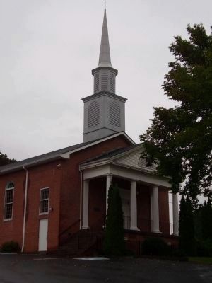
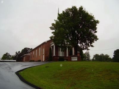
Cherokee Baptist Church image. Click for full size.
Photographed By Stanley and Terrie Howard, September 26, 2009
2. Cherokee Baptist Church
Cherokee Baptist Church image. Click for full size.
Photographed By Stanley and Terrie Howard, September 26, 2009
3. Cherokee Baptist Church
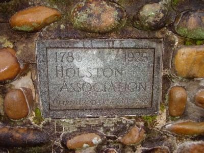
Holston Association image. Click for full size.
Photographed By Stanley and Terrie Howard, September 26, 2009
4. Holston Association
1786 1926
Holston Association
Organized Oct. 30, 1786
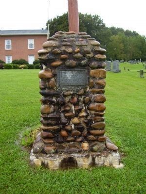
Holston Association Marker and Cherokee Baptist Church image. Click for full size.
Photographed By Stanley and Terrie Howard, September 26, 2009
5. Holston Association Marker and Cherokee Baptist Church
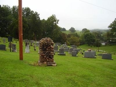
Cherokee Baptist Church Cemetery image. Click for full size.
Photographed By Stanley and Terrie Howard, September 26, 2009
6. Cherokee Baptist Church Cemetery
 
 
Credits. This page was last revised on March 27, 2017. It was originally submitted on September 28, 2009, by Stanley and Terrie Howard of Greer, South Carolina. This page has been viewed 1,326 times since then and 27 times this year. Last updated on March 6, 2015, by J. Makali Bruton of Accra, Ghana. Photos:   1, 2, 3, 4, 5, 6. submitted on September 28, 2009, by Stanley and Terrie Howard of Greer, South Carolina. • Bill Pfingsten was the editor who published this page.
Share this page.  
Share on Tumblr
m=81253

CeraNet Cloud Computing sponsors the Historical Marker Database.
This website earns income from purchases you make after using our links to Amazon.com. We appreciate your support.
Paid Advertisement
Apr. 24, 2024