Elizabethton in Carter County, Tennessee — The American South (East South Central)
Green Hill Cemetery
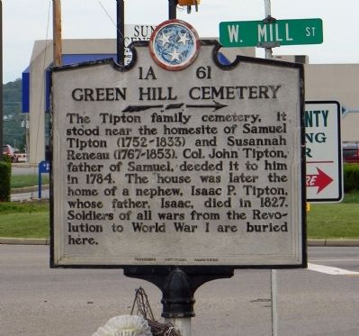
Photographed by Paul Crumlish, July 17, 2011
1. Green Hill Cemetery Marker
Erected by Tennessee Historical Commission. (Marker Number 1A 61.)
Topics and series. This historical marker is listed in this topic list: Cemeteries & Burial Sites. In addition, it is included in the Tennessee Historical Commission series list. A significant historical year for this entry is 1784.
Location. 36° 21.085′ N, 82° 13.998′ W. Marker is in Elizabethton, Tennessee, in Carter County. It is at the intersection of West Elk Avenue (U.S. 321) and West Mill Street on West Elk Avenue. Touch for map. Marker is at or near this postal address: 421 West Elk Avenue, Elizabethton TN 37643, United States of America. Touch for directions.

Regionally, this marker is in East Tennessee and in the Tri-Cities Area. It is also in the American South, specifically in the Upper South,
this page online
Other nearby markers. At least 8 other markers are within walking distance of this marker: Bemberg Water Tower (approx. 0.4 miles away); Bemberg Station / Port Rayon (approx. half a mile away); Boone Trail Highway (approx. 0.9 miles away); S.H. Kress Building (approx. 0.9 miles away); 60 Missing in Action and Prisoners of War from Carter County (approx. one mile away); Distinguished Service Cross Recipients from Carter County (approx. one mile away); Elizabethton Carter County Veterans Walk of Honor (approx. one mile away); Veterans Walkway and Monument (approx. one mile away). Touch for a list and map of all markers in Elizabethton.
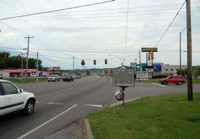
Photographed by Paul Crumlish, July 17, 2011
2. Wide view of Green Hill Cemetery Marker
Credits. This page was last revised on June 16, 2016. It was originally submitted on August 24, 2011, by PaulwC3 of Northern, Virginia. This page has been viewed 1,733 times since then and 40 times this year. Last updated on March 12, 2015, by J. Makali Bruton of Washington, District of Columbia. Photos: 1, 2. submitted on August 24, 2011, by PaulwC3 of Northern, Virginia. • Bill Pfingsten was the editor who published this page.
