Blues Beach in Hampshire County, West Virginia — The American South (Appalachia)
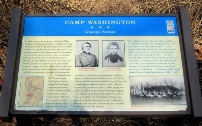
Camp Washington
Strategic Position
Confederate Lt. Col. Turner Ashby, 7th Virginia Cavalry, established his headquarters here early in the summer of 1861, after Federal forces temporarily withdrew. His younger brother, Richard Ashby, died here from wounds sustained in an engagement on Kelly’s Island on the Potomac River on June 28. Turner Ashby took his brother’s death hard, and his grief intensified his determination to fight. Almost a year later, on June 6, 1862, Turner Ashby was killed in action south of Harrisonburg, Virginia. His remains lie in Stonewall Cemetery in Winchester, Virginia. At first Richard Ashby was buried in Indian Mound Cemetery in Romney, but after the war his body was disinterred and re-buried beside his brother.
“Poor Dick went into the war like myself, not to regard himself or our friends, but to serve our country in this time of peril. …His country has lost the services of a brave man with a strong arm, which he proved upon her enemies in losing his life. …He was buried with all the honors of war, and never was greater respect paid to the memory of one man; it was indeed a triumph of his bravery. I had him buried in a beautiful cemetery in Romney.” — Turner Ashby to his sister Dora, Camp Washington, July 7, 1861
(captions)
(top center) Gen. Benjamin F. Kelley; Gen. Turner Ashby Courtesy Library of Congress
(lower right) Civil War camp, 1861 - Courtesy Library of Congress
Erected by West Virginia Civil War Trails.
Topics and series. This historical marker is listed in this topic list: War, US Civil. In addition, it is included in the West Virginia Civil War Trails series list. A significant historical month for this entry is June 2002.
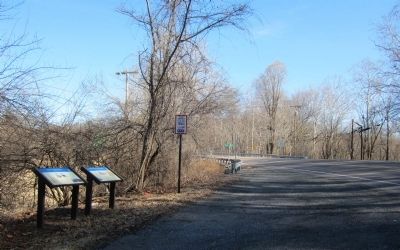
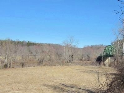
Location. Marker has been reported missing. It was located near 39° 25.551′ N, 78° 42.941′ W. Marker was in Blues Beach, West Virginia, in Hampshire County. Marker was at the intersection of Cumberland Road (West Virginia Route 28) and Long Road (County Route 28/4), on the left when traveling north on Cumberland Road. Located at the south end of the bridge over South Branch Potomac River. Touch for map. Marker was in this post office area: Springfield WV 26763, United States of America. Touch for directions.
Other nearby markers. At least 8 other markers are within 6 miles of this location, measured as the crow flies. Wire Bridge Engagement (within shouting distance of this marker); Mount Bethel Church (approx. 3.7 miles away); Fort Forman (approx. 3.7 miles away); The Guns Of Jacob Sheetz (approx. 4 miles away); Old District Parsonage (approx. 6 miles away); Fort Ashby (approx. 6.1 miles away); a different marker also named Fort Ashby (approx. 6.1 miles away); American Discovery Trail (approx. 6.1 miles away).
Additional commentary.
1. Marker is missing?
I visited this site on 5/14/2023 and did not see the Camp Washington Marker. There was an adjacent marker that got moved to the other side of the road. The bridge itself was replaced in early 2022 and they probably removed both markers during construction. I don't know if this one was moved to a different location or permanently removed.
— Submitted May 25, 2023, by Michael Kleen of Woodbridge, Virginia.
Credits. This page was last revised on June 1, 2023. It was originally submitted on March 12, 2015, by Bernard Fisher of Richmond, Virginia. This page has been viewed 852 times since then and 33 times this year. Photos: 1, 2, 3. submitted on March 12, 2015, by Bernard Fisher of Richmond, Virginia.


