Cumberland in Allegany County, Maryland — The American Northeast (Mid-Atlantic)
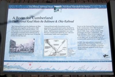
A Boom for Cumberland
The National Road Meets the Baltimore & Ohio Railroad
— The Historic National Road / The Road That Built The Nation —
The National Road and the Baltimore & Ohio Railroad came together at this spot in 1842 at Cumberland’s first railroad station. For a few years, it was necessary for passengers and freight to transfer from railroad cars to coach and wagon for the trip west. It was the reverse for the trip east.
National Road traffic flourished and the population of Cumberland nearly doubled by 1850, as Cumberland enjoyed a brief but lively boom. Old businesses expanded, new ones thrived. Construction filled the city with new warehouses, hotels and repair shops.
Travel on the National Pike thrived prior to the construction of the B&O Railroad. Throughout the first three weeks of March, 1848, stage coaches carried 2,586 passengers through Cumberland. One local old-timer claims to have sighted “fifty-two six-horse wagons...on the road at one time, and...at least 4,000 head of western cattle quartered at a single place.”
In 1853, the railroad was completed to Wheeling, West Virginia. Travel on the National Road declined as speedier steam railroads replaced horse-drawn stagecoaches.
[Captions:]
With the railroad station and the National Road intersection at its eastern end, Baltimore Street became the business address to have.
Early 20th century map of Cumberland detailing locations of major transportation routes.
Topics. This historical marker is listed in these topic lists: Industry & Commerce • Railroads & Streetcars • Roads & Vehicles. A significant historical year for this entry is 1842.
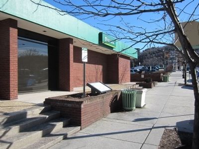
Location. 39° 39.129′ N, 78° 45.574′ W. Marker is in Cumberland, Maryland, in Allegany County. Marker is at the intersection of Baltimore Street and North George Street, on the right when traveling west on Baltimore Street. Touch for map. Marker is in this post office area: Cumberland MD 21502, United States of America. Touch for directions.
Other nearby markers. At least 8 other markers are within walking distance of this marker. Capture of Generals B.F. Kelly and George Crook (a few steps from this marker); Capture of Generals (within shouting distance of this marker); McNeill’s Raid (within shouting distance of this marker); Christ's (St. Paul's) Lutheran Church (about 500 feet away, measured in a direct line); Welcome (about 600 feet away); B’er Chayim (Well of Life) Congregation (about 600 feet away); The First National Bank and Trust Company of Western Maryland (about 600 feet away); Girritta Park (approx. 0.2 miles away). Touch for a list and map of all markers in Cumberland.
Credits. This page was last revised on December 9, 2021. It was originally submitted on March 13, 2015, by Bernard Fisher of Richmond, Virginia. This page has been viewed 807 times since then and 47 times this year. Photos: 1, 2. submitted on March 13, 2015, by Bernard Fisher of Richmond, Virginia.

