Melrose in Nashville in Davidson County, Tennessee — The American South (East South Central)
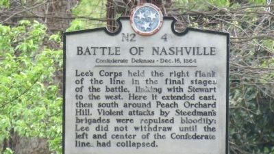
Battle of Nashville
Confederate Defenses - Dec. 16, 1864
Erected by TN Historical Commission. (Marker Number N2 4.)
Topics and series. This historical marker is listed in this topic list: War, US Civil. In addition, it is included in the Tennessee Historical Commission series list.
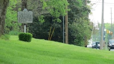
Location. 36° 5.355′ N, 86° 46.28′ W. Marker is in Nashville, Tennessee, in Davidson County. It is in Melrose. Marker is at the intersection of Franklin Pike (Tennessee Route 31) and Curtiswood Lane North, on the right when traveling north on Franklin Pike. Touch for map. Marker is in this post office area: Nashville TN 37204, United States of America. Touch for directions.
Other nearby markers. At least 8 other markers are within 2 miles of this marker, measured as the crow flies. A different marker also named Battle of Nashville (approx. ¼ mile away); Robertson Academy (approx. 0.6 miles away); a different marker also named Battle of Nashville (approx. 0.9 miles away); Battle of Nashville / Peach Orchard Hill (approx. 0.9 miles away); Travellers Rest (approx. one mile away); a different marker also named Travellers' Rest (approx. 1.1 miles away); Glendale Park (approx. 1.2 miles away); Monroe Harding (approx. 1.4 miles away). Touch for a list and map of all markers in Nashville.
Related marker. Click here for another marker that is related to this marker. To better understand the relationship, study each marker in the order shown.
Credits. This page was last revised on February 7, 2023. It was originally submitted on April 1, 2012, by Tom Gillard of Tullahoma, Tennessee. This page has been viewed 1,028 times since then and 18 times this year. Last updated on March 13, 2015, by J. Makali Bruton of Accra, Ghana. Photos: 1, 2. submitted on April 1, 2012, by Tom Gillard of Tullahoma, Tennessee. • Bill Pfingsten was the editor who published this page.

