Near Berlin in Worcester County, Maryland — The American Northeast (Mid-Atlantic)
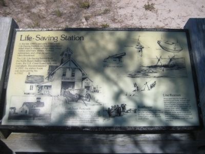
Life-Saving Station
In the late 1800's and early 1900's four Life-Saving Stations on Assateague Island aided ships in distress off the coast, where hidden sand bars, storms, German submarines, and other dangers often threatened.
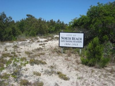
The U.S. Life-Saving Service built the North Beach Station here in 1884. Later, the U.S. Coast Guard took over operations. Decommissioned in 1952, the station house was destroyed by fire in 1962.
Surf Boat Rescues
The crew of the North Beach Station rowed out to rescue shipwreck survivors in 24-foot long wooden boats. The keep directed and stteered while six surfmen manned the oars. Launching and landing through the roaring breakers required courage and skill.
Boathouse
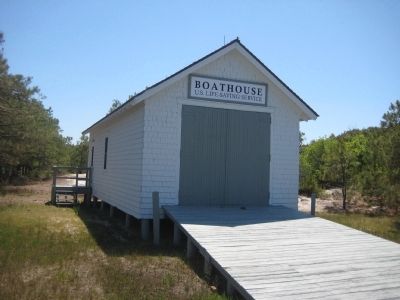
The building behind you was once the auxiliary boathouse of the Pope Island Life-Saving Station which stood 13 miles south of here.
Line Rescues
When seas were too rough for launching surf boats, rescuers shot lightweight lines out to ships with guns or rockets. Crewman on the ships could use the lines to pull out heavier ropes called "hawsers." A hawser firmly attached between ship and shore served as an aerial track for rescue devices suspended from pulleys. A breeches-buoy carried one person; a surf car could carry five.
Erected by National Park Service, U.S. Department of the Interior.
Topics. This historical marker is listed in these topic lists: Government & Politics • Waterways & Vessels. A significant historical year for this entry is 1884.
Location. This marker has been replaced by another marker nearby. It was located near 38° 11.934′ N, 75° 9.409′ W. Marker was near Berlin, Maryland, in Worcester County. Marker was on Bayberry Drive, half a mile south of Bayside Drive, on the left when traveling south. Marker is on the northeast corner of the intersection. Located in Assateague Island National Seashore. Touch for map. Marker was in this post office area: Berlin MD 21811, United States of America. Touch for directions.
Other nearby markers. At least 8 other markers are within 3 miles of this location, measured as the crow flies. Saving Lives (within shouting distance of this marker); Native Americans (within shouting distance of this marker); Olde Sinepuxent (approx. 0.4 miles away); Keep Them Safe / Keep Them Wild (approx. half a mile away); a different marker also named Keep Them Safe / Keep Them Wild (approx. 0.6 miles away); Baltimore Boulevard (approx. 0.7 miles away); Wild and Free (approx. 2.8 miles away); Peregrine Falcon Migration (approx. 2.8 miles away). Touch for a list and map of all markers in Berlin.
More about this marker. On the lower left is a photograph
of the North Beach Life-Saving Station as it looked from the point in the 1920's. A drawing on the left half of the marker depict the station as it looked in operation. Other drawing show a Lyle gun with a maximum effective range of 400 yards (used to throw the lifeline), and a Breechers-Buoy, a Surf Car. Below these is an illustration showing the rescue equipment in operation saving sailors from a sinking ship.
Related marker. Click here for another marker that is related to this marker. This marker has been replaced by the linked marker.
Also see . . . Assateague Island National Seashore. National Park Service site. (Submitted on June 15, 2008, by Craig Swain of Leesburg, Virginia.)
Credits. This page was last revised on September 18, 2022. It was originally submitted on June 4, 2008, by F. Robby of Baltimore, Maryland. This page has been viewed 1,500 times since then and 9 times this year. Photos: 1, 2, 3. submitted on June 4, 2008, by F. Robby of Baltimore, Maryland. 4. submitted on June 15, 2008, by Craig Swain of Leesburg, Virginia.


