Belle Meade in Davidson County, Tennessee — The American South (East South Central)
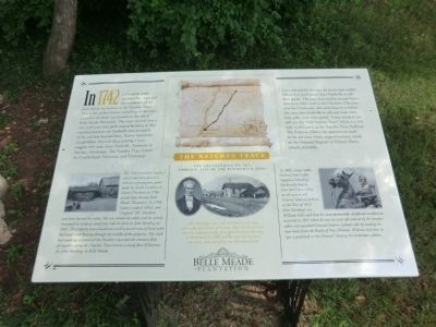
The Natchez Trace
Belle Meade Plantation
Photographed by Don Morfe, July 25, 2013
1. The Natchez Trace Marker
this page online
(captions)
(photo, lower left) The “Old Dunham’s Station” which had been part of a 640-acre preemption grant made by North Carolina to Daniel Dunham in 1786 would later become Belle Meade Plantation. In 1788, Indians scalped, killed, and “chopped” Mr. Dunham and later burned his cabin. His son rebuilt the cabin and the family remained in residence until they sold the farm to John Harding in 1807. The property was considered a well-watered tract of land with Richland creek flowing through the middle of the property. The creek bed made up a section of the Natchez trace and the constant flow of travelers along the Natchez Trace meant a steady flow of business for John Harding, at Belle Meade.
(photos, center) You are standing on the original site of the Blacksmith shop.---John Harding’s saw mill and blacksmith shop were valuable sources of income. Ben, the blacksmith, was an enslaved worker purchased by John Harding in Richmond in 1806 and the only documented run-away slave owned by the Harding family.
(photo,lower right) In 1814, troops under General John Coffee
Photographed by Don Morfe, July 25, 2013
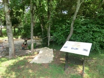
2. The Natchez Trace Marker
Erected by Belle Meade Plantation.
Topics and series. This historical marker is listed in these topic lists: African Americans • Roads & Vehicles. In addition, it is included in the Former U.S. Presidents: #07 Andrew Jackson, and the Natchez Trace series lists. A significant historical year for this entry is 1742.
Location. 36° 6.412′ N, 86° 51.953′ W. Marker is in Belle Meade, Tennessee, in Davidson County. It can be reached from Harding Pike (U.S. 70S) 0.2 miles north of Leake Avenue, on the right when traveling north. This marker is on the grounds of the Belle Meade Plantation. Touch for map. Marker is at or near this postal address: 5025 Harding Pike,
Photographed by Don Morfe, July 25, 2013
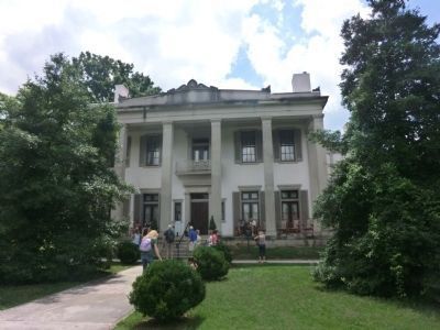
3. Belle Meade Plantation Mansion

Regionally, this marker is in Middle Tennessee and in Greater Nashville. It is also in the American South and specifically in the Upper South. Globally, it is in North America, the Western Hemisphere, the Western World, and the Anglosphere. Historically, it finds itself in what was once the territory of the Mississippian Culture, one of the Confederate States of America, and the Antebellum South.
Other nearby markers. At least 8 other markers are within walking distance of this marker: The Belle Meade Railway Station (about 400 feet away, measured in a direct line); Dairy (about 400 feet away); War on the Home Front (about 400 feet away); Belle Meade Plantation (about 400 feet away); a different marker also named Belle Meade Plantation (about 400 feet away); Slave Cabin (about 500 feet away); Belle Meade Bourbon (about 500 feet away); Ice House (about 500 feet away).
Another marker is no longer nearby. In 1865 (was about 500 feet away but has been replaced with another marker now near it).
Also see . . . Belle Meade Plantation. (Submitted on October 3, 2013.)
Photographed by Don Morfe, July 25, 2013
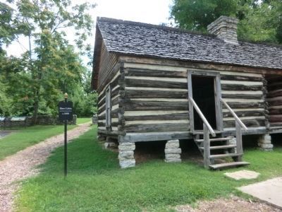
4. Belle Meade slave quarters
Photographed by Don Morfe, July 25, 2013
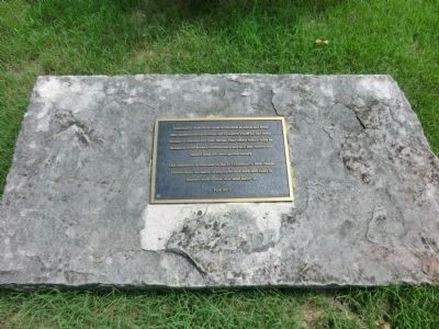
5. Belle Meade Plantation Bicentennial Plaque
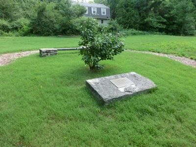
Dedicated to those whom came to this farm as slaves and freed men, names known and others lost to history, whose toil and sweat turned a wilderness into Belle Meade. Their efforts remain today as testament to the artistry, craftsmanship and skill that created his nation’s premiere thoroughbred nursery. This monument is dedicated on the Bi-Centennial of Belle Meade Plantation by the family of employees that work here today in remembrance of those that came before us. Fall 2007
Photographed by Don Morfe, July 25, 2013
6. Distant photo of the dedication plaque
Credits. This page was last revised on June 16, 2016. It was originally submitted on October 3, 2013, by Don Morfe of Baltimore, Maryland. This page has been viewed 1,989 times since then and 60 times this year. Last updated on March 14, 2015, by J. Makali Bruton of Washington, District of Columbia. Photos: 1, 2, 3, 4, 5, 6. submitted on October 3, 2013, by Don Morfe of Baltimore, Maryland. • Bill Pfingsten was the editor who published this page.
