Capitol District in Richmond, Virginia — The American South (Mid-Atlantic)
The Treasury Building of the Confederate States of America
Inscription.
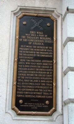
This wall was once a part of the Treasury Building of the Confederate States of America.
In it were the offices of the President, the Secretary of State, the Secretary of the Treasury, and the Treasurer of the Confederate Government.
Here too President Jefferson Davis, who had been indicted May 8, 1866 under the charge of treason against the United States, appeared either in person or by counsel before the Circuit Court of the United States demanding trial, first on June 5, 1866 and in all seven times, each time trial was postponed upon request of the Government and the case was ended forever without trial by formal dismissal , February 15, 1869.
Erected 1913 by the Confederate Memorial Literary Society.
Topics. This historical marker is listed in this topic list: War, US Civil. A significant historical date for this entry is February 15, 1918.
Location. Marker is missing. It was located near 37° 32.25′ N, 77° 26.101′ W. Marker was in Richmond, Virginia. It was in the Capitol District. Marker was on East Main Street (U.S. 60) east of North 10th Street, on the right when traveling east. Marker is on The United States Courthouse, to the left of the main doors. Touch for map. Marker was in this post office area: Richmond VA 23219, United States of America. Touch for directions.
Other nearby markers. At least 8 other markers are within walking distance of this location. Richmond Bread Riot (within shouting distance of this marker); Oliver White Hill Sr. (within shouting distance of this marker); Spottswood W. Robinson III (within shouting distance of this marker); Richmond Evacuation Fire (about 400 feet away, measured in a direct line); Great Turning Basin (about 500 feet away); The Bell Tower (about 500 feet away); Mantle (about 500 feet away); Anna Maria Lane (about 500 feet away). Touch for a list and map of all markers in Richmond.
Also see . . . First Reports of the Confederate Treasury. Delivered in 1861, a set of documents outlining the economic status of the newly formed Confederacy. (Submitted on June 6, 2008, by Craig Swain of Leesburg, Virginia.)
Credits. This page was last revised on February 1, 2023. It was originally submitted on June 5, 2008, by J. J. Prats of Powell, Ohio. This page has been viewed 1,507 times since then and 32 times this year. Photos: 1, 2, 3, 4. submitted on June 5, 2008, by J. J. Prats of Powell, Ohio. • Craig Swain was the editor who published this page.


