Greeneville in Greene County, Tennessee — The American South (East South Central)
Andrew Johnson National Cemetery
Andrew Johnson National Historic Site
| — | National Park Service, U.S. Department of the Interior | — |
Photographed by Bill Coughlin, August 4, 2012
1. Andrew Johnson National Cemetery Marker
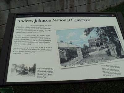
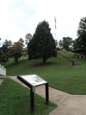
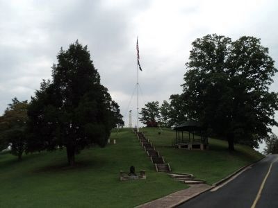
Andrew Johnson chose to be buried atop this hill, then known as “Signal Hill,” which he owned. His family members continued to be buried here in the family plot until his great-granddaughter’s interment in 1992. The cemetery became part of Andrew Johnson National Monument in 1942.
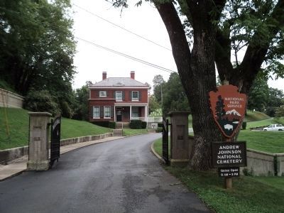
The U.S. Army built this lodge based on a prototype design by General Montgomery C. Meigs for military cemeteries. Cemetery caretakers and their families originally lived in the lodge. Today it contains National Park Service administrative offices, and the cemetery’s former stable behind you is now the park’s maintenance area.
“Whereas, by an Act of Congress, approved June 12, 1906, the Secretary of War is hereby authorized to accept, under the will of Martha J. Patterson … the tract of land where said Andrew Johnson’s remains now lie, known as ‘Monument Hill.’”
Excerpt from Deed Book
Erected by National Park Service, U.S. Department of the Interior.
Topics and series. This historical marker is listed in this topic list: Cemeteries & Burial Sites. In addition, it is included in the Former U.S. Presidents: #17 Andrew Johnson, and
this page online
Location. 36° 9.386′ N, 82° 50.236′ W. Marker is in Greeneville, Tennessee, in Greene County. It is on Monument Avenue, on the left when traveling south. Touch for map. Marker is in this post office area: Greeneville TN 37743, United States of America. Touch for directions.

Regionally, this marker is in East Tennessee. It is also in the American South, specifically in the Upper South, in Appalachia, and specifically in Southern Appalachia. Globally, it is in North America, the Western Hemisphere, the Western World, and the Anglosphere. Historically, it finds itself in what was once the original Cherokee Nation, the territory of the Mississippian Culture, one of the Confederate States of America, the State of Franklin, and the Antebellum South.
Other nearby markers. At least 8 other markers are within walking distance of this marker: Address by President Lincoln (a few steps from this marker); World War I Memorial (within shouting distance of this marker); Andrew Johnson and Eliza Johnson Grave Marker (about 300 feet away, measured in
Photographed by Bill Coughlin, August 4, 2012
2. Andrew Johnson National Cemetery Marker
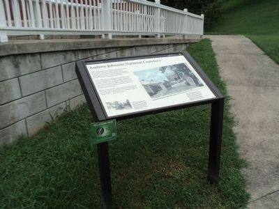
More about this marker. The right side of the marker contains a post card showing the Entrance to Andrew Johnson National Cemetery, Greenville, Tenn. It has a caption of “This post card shows what the Andrew Johnson National Cemetery looked like soon after it opened in 1908. This active military cemetery continues to serve our nation’s military families. Other than Andersonville, this is the only military cemetery administered by the National Park Service that receives new burials.”
A photo at the lower left of the marker includes the caption, “Workers spread asphalt on the road to Andrew Johnson’s grave. The road was part of a series of improvements made by the War Department when it became the Andrew Johnson National Cemetery in 1906.”
Photographed by Bill Coughlin, August 4, 2012
3. Marker in Andrew Johnson National Cemetery
Photographed by Bill Coughlin, August 4, 2012
4. Johnson's grave as seen from the marker
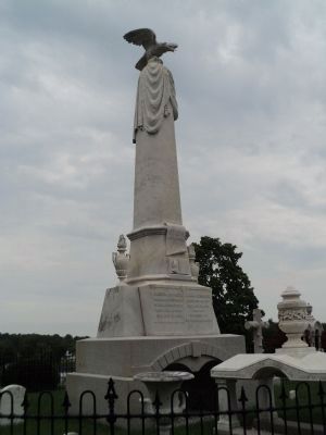
Photographed by Bill Coughlin, August 4, 2012
5. Grave of President Andrew Johnson
Photographed by Bill Coughlin, August 4, 2012
6. Andrew Johnson National Cemetery
The lodge mentioned on the marker can be seen beyond the cemetery gates.
Credits. This page was last revised on November 8, 2021. It was originally submitted on August 13, 2012, by Bill Coughlin of Woodland Park, New Jersey. This page has been viewed 1,029 times since then and 45 times this year. Last updated on March 17, 2015, by J. Makali Bruton of Washington, District of Columbia. Photos: 1, 2, 3, 4, 5, 6. submitted on August 13, 2012, by Bill Coughlin of Woodland Park, New Jersey. • Bill Pfingsten was the editor who published this page.
