
Montgomery in Montgomery County, Alabama — The American South (East South Central)
General Charles Graham Boyd
Photographed by Mark Hilton, January 19, 2014
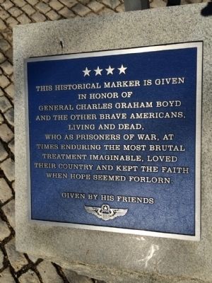
1. General Charles Graham Boyd Marker
in honor of
General Charles Graham Boyd
and the other brave Americans,
living and dead,
who as prisoners of war, at
times enduring the most brutal
treatment imaginable, loved
their country and kept the faith
when hope seemed forlorn.
Given by his friends
Erected by the Friends of General Charles Graham Boyd.
Topics. This historical marker is listed in this topic list: War, Vietnam.
Location. 32° 22.871′ N, 86° 18.651′ W. Marker is in Montgomery, Alabama, in Montgomery County. It is at the intersection of Coosa Street and Tallapoosa Street, on the right when traveling north on Coosa Street. Touch for map. Marker is at or near this postal address: 200 Coosa Street, Montgomery AL 36104, United States of America. Touch for directions.

Regionally, this marker is in Alabama’s Tri-Counties River Region. It is also in the American South, specifically in the Deep South, and in the Black Belt. Globally, it is in North America, a Gulf of Mexico state, the Western Hemisphere, the Western World, and the Anglosphere. Historically,
this page online
Other nearby markers. At least 8 other markers are within walking distance of this marker: Confederate Military Prison / Civil War Military Prisons (here, next to this marker); Marquis de Lafayette (about 500 feet away); Encanchata (about 600 feet away); Murphy House (about 600 feet away); The Montgomery Slave Trade / Warehouses Used in the Slave Trade (about 600 feet away); Montgomery Freemasonry (about 700 feet away); The Domestic Slave Trade / Slave Transportation to Montgomery (about 700 feet away); Struggle For Colonial Empire (about 700 feet away). Touch for a list and map of all markers in Montgomery.
Another marker is no longer nearby. Union Station & Riverfront Park / Lower Commerce Street (was about 500 feet away, measured in a direct line but has been confirmed missing).
Also see . . .
1. Wikipedia article on General Boyd. (Submitted on March 19, 2015, by Mark Hilton of Montgomery, Alabama.)
2. POW Network Bio on General Boyd. (Submitted on March 19, 2015, by Mark Hilton of Montgomery, Alabama.)
Photographed by Mark Hilton, January 19, 2014
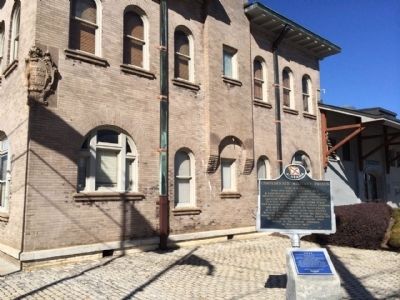
2. Marker in front of the Montgomery Biscuits Baseball Stadium.
Photographed by Mark Hilton, January 19, 2014
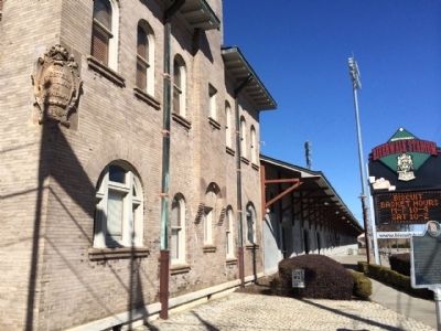
3. Biscuits Stadium and former Western Railway of Alabama Building (1898)
Photographed by Mark Hilton, January 19, 2014
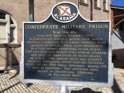
4. Historical marker just above this monument.
Credits. This page was last revised on June 16, 2016. It was originally submitted on March 19, 2015, by Mark Hilton of Montgomery, Alabama. This page has been viewed 909 times since then and 24 times this year. Photos: 1, 2, 3, 4. submitted on March 19, 2015, by Mark Hilton of Montgomery, Alabama.
