Near Norden in Nevada County, California — The American West (Pacific Coastal)
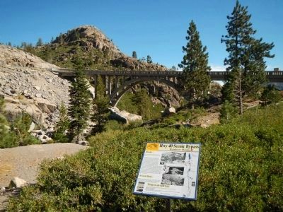
Rainbow Bridge
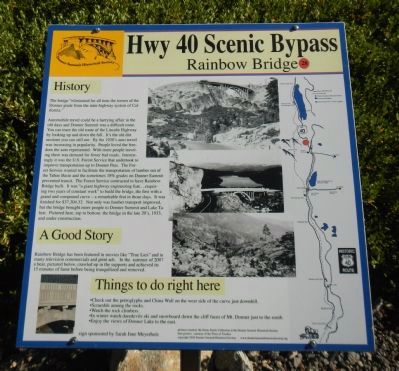
The bridge “eliminated for all time the terrors of the Donner grade from the state highway system of California.”
Automobile travel could be a harrying affair in the old days and Donner Summit was a difficult route. You can trace the old route of the Lincoln Highway by looking up and down the hill. It’s the old dirt sections you can still see. By the 1920’s auto travel was increasing in popularity. People loved the freedom the auto represented. With more people traveling there was demand for fewer bad roads. Interestingly it was the U.S. Forest Service that undertook to improve transportation up to Donner Pass. The Forest Service wanted to facilitate the transportation of lumber out of the Tahoe Basin and the sometimes 18% grades on Donner Summit prevented transit. The Forest Service contracted to have Rainbow Bridge built. It was “a giant highway engineering feat… requiring two years of constant work” to build the bridge, the first with a grand and compound curve - a remarkable feat in those days. It was finished for $37,304.32. Not only was lumber transport improved, but the bridge brought more people to Donner Summit and Lake Tahoe. Pictured here, top to bottom: the bridge in the late 20’s, 1933, and under construction.
A Good Story
Rainbow Bridge has been featured in movies like “True Lies” and in many television commercials and print ads. In the summer of 2007 a bear, pictured below, crawled up in the supports and achieved its 15 minutes of fame before being tranquilized and remove.
Things to do right here
• Check out the petroglyphs and China Wall on the west side of the curve just downhill.
• Scramble among the rocks.
• Watch the rock climbers
• In winter watch daredevils ski and snowboard down the cliff faces of • Mt. Donner just to the south.
• Enjoy the views of Donner Lake to the east.
Erected by Donner Summit Historical Society. (Marker Number 28.)
Topics and series. This historical marker is listed in these topic lists: Bridges & Viaducts • Roads & Vehicles. In addition, it is included in the Donner Summit Historical Society, and the Nevada - 20-Mile Museum - Hwy 40 Scenic Bypass series lists. A significant historical year for this entry is 1933.
Location. 39° 19.13′ N, 120° 19.167′ W. Marker is near Norden, California, in Nevada County. Marker is on Donner Pass Road, on the right when traveling east. Touch for map. Marker is at or near this postal address: 18702 Donner Pass Road, Norden CA 95724, United States of America. Touch for directions.
Other nearby markers. At least 8 other markers are within walking distance of this marker. Stephens – Townsend – Murphy Party of 1844 (within shouting distance of this marker); Donner Pass (about 300 feet away, measured in a direct line); McGlashan Point (about 300 feet away); Transcontinental Railroad (about 300 feet away); Donner Summit Overlook (about 300 feet away); Donner Summit Bridge (about 300 feet away); Petroglyphs (about 500 feet away); China Wall (about 600 feet away). Touch for a list and map of all markers in Norden.
Regarding Rainbow Bridge. This marker is removed every Fall for the winter months and replaced every Spring for the summer season.
Also see . . . The 20-Mile Museum Brochure. Information and the listing of all the markers within this series. (Submitted on March 28, 2015.)
Credits. This page was last revised on November 10, 2020. It was originally submitted on March 24, 2015, by Barry Swackhamer of Brentwood, California. This page has been viewed 476 times since then and 21 times this year. Photos: 1, 2. submitted on March 24, 2015, by Barry Swackhamer of Brentwood, California. • Syd Whittle was the editor who published this page.

