Vicksburg National Military Park in Warren County, Mississippi — The American South (East South Central)
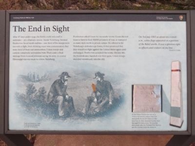
The End In Sight
Pemberton asked Grant for surrender terms. Grant did not want to have to feed 30,000 prisoners of war, or transport so many men north to prison camps. He offered to let Vicksburg’s defenders go home, if they promised they would not fight against the United States again until exchanged. Pemberton accepted the terms. On July 4th, the Confederates handed over their guns. Union troops marched victoriously into the city.
On 3rd July 1863 at about ten o’clock a.m., white flags appeared on a portion of the Rebel works. It was a glorious sight to officers and soldiers on the line…
Ulysses S. Grant
(captions)
(lower left) Grant and Pemberton meet to discuss the Confederate surrender of Vicksburg.
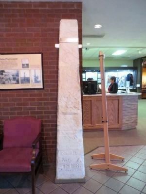
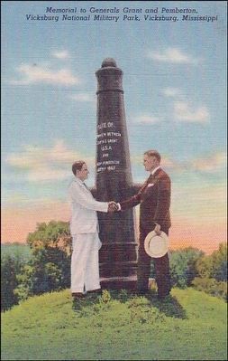
(lower right) At the Visitor center you can see a 10-foot-tall marble column that first marked the Surrender Interview Site near here in 1864. Souvenir hunters later damaged the monument. To keep this monument safe, the National Park Service put the column inside the museum.
Erected by Vicksburg National Military Park.
Topics. This historical marker is listed in this topic list: War, US Civil. A significant historical month for this entry is July 1738.
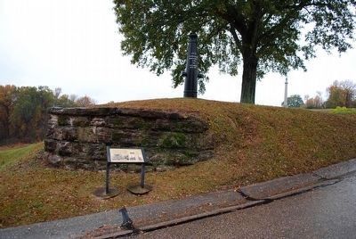
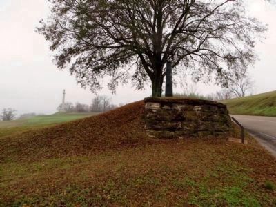
Location. 32° 21.447′ N, 90° 50.675′ W. Marker is in Vicksburg National Military Park, Mississippi, in Warren County. Marker is on Pemberton Avenue east of Confederate Avenue, on the right when traveling east. Located in Vicksburg National Military Park. Touch for map. Marker is in this post office area: Vicksburg MS 39183, United States of America. Touch for directions.
Other nearby markers. At least 8 other markers are within walking distance of this marker. The Surrender Interview Site (a few steps from this marker); Mississippi 38th Infantry (about 300 feet away, measured in a direct line); C.S. Appeal (Arkansas) Battery; (about 300 feet away); a different marker also named C.S. Appeal (Arkansas) Battery; (about 400 feet away); Pembroke S· Senteny (about 400 feet away); Eugene Erwin (about 400 feet away); Melancthon Smith (about 500 feet away); C S Missouri (about 500 feet away). Touch for a list and map of all markers in Vicksburg National Military Park.
Also see . . . Vicksburg National Military Park. (Submitted on March 25, 2015.)
Photographed By William Bruce
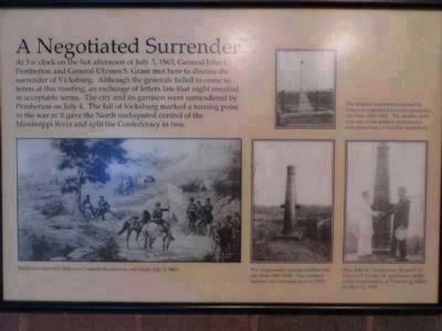
6. A Negotiated Surrender Marker (moved to Visitor Center)
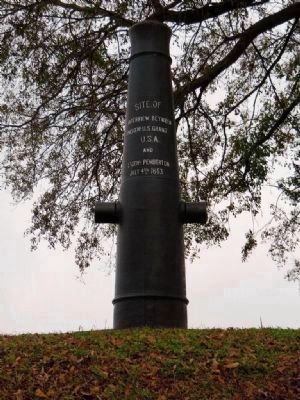
At 3 o'clock on the hot afternoon of July 3, 1863, General John C. Pemberton and General Ulysses S. Grant met here to discuss the surrender of Vicksburg. Although the generals failed to come to terms at this meeting, an exchange of letters late that night resulted in acceptable terms. The city and its garrison were surrendered by Pemberton on July 4. The fall of Vicksburg marked a turning point in the war as it gave the North undisputed control of the Mississippi River and split the Confederacy in two.
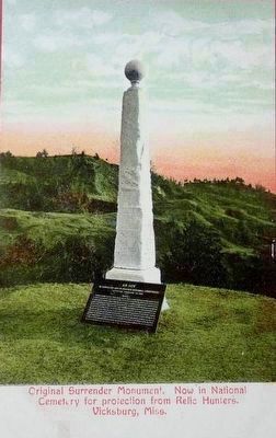
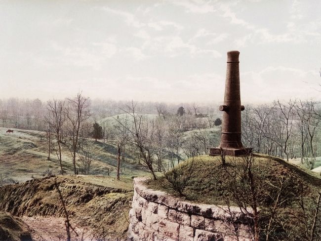
Image by Detroit Photographic Company, circa 1910
8. Original Surrender Monument in Vicksburg National Cemetery
This vintage postcard view shows the original surrender monument when it was located in the Vicksburg National Cemetery, i.e. after it was removed from the original site, but before it was relocated indoors to the visitor center. Note that it have had, apparently, its own marker, but the resolution of this image is too low to read more than the title lines, "An Act - To Establish and to Protect National Cemeteries...".
Credits. This page was last revised on June 8, 2017. It was originally submitted on March 25, 2015, by William Bruce of Madison, Wisconsin. This page has been viewed 718 times since then and 23 times this year. Photos: 1. submitted on March 25, 2015, by William Bruce of Madison, Wisconsin. 2. submitted on September 4, 2015, by Brandon Fletcher of Chattanooga, Tennessee. 3, 4, 5, 6. submitted on March 25, 2015, by William Bruce of Madison, Wisconsin. 7, 8, 9. submitted on August 30, 2015. • Bernard Fisher was the editor who published this page.
