Doe Creek Church and School
Brothers against Brothers
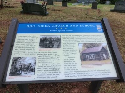
During the war, Samuel G. Kennedy and James M. Smith were killed. Unionists here had warned James D. Kennedy and Bill Nails not to return if they fought for the Confederacy. After the war ended, Kennedy and Nails returned to Doe Creek, and Union sympathizers murdered both of them three miles from here at Wormly Branch. Robert Kennedy brought their bodies here for burial, thus creating a community cemetery where several other Confederate veterans, including Isham Gurley, were later interred. The arguing continued into the early 1900’s,
this page online
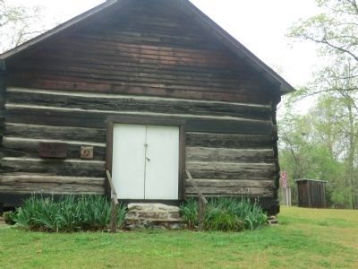
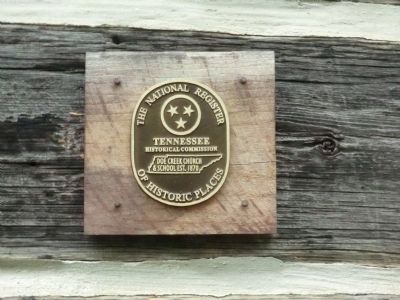
About 1870, Robert Kennedy donated land, furnished logs, and provided oxen to move the logs here for a one-room church and school, where congregations met on Sundays and children took lessons during the week. The school served the community until the late 1940s. For 54 years Elmer Duck, Robert Kennedy’s grandson, taught here.
(Inscription under the photo in the lower left)
Partisans murdering civilians, Harper’s Weekly, Sept. 5, 1863.
(Inscription under the photo in the upper center)
Guerrillas on both sides stole horses from civilians, Harper’s Weekly, Dec 24, 1864.
(Inscription under the photo in the lower right)
Doe Creek Church and School before restoration-Courtesy Golden Circle Graphics.
Erected by Tennessee Civil War Trails.
Topics and series. This historical marker is listed in these topic lists: Education • Religion & Religious Structures • Settlements & Settlers • War, US Civil. In addition, it is included in the Tennessee Civil War Trails
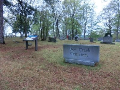
Location. 35° 28.164′ N, 88° 14.85′ W. Marker is in Sardis, Tennessee, in Henderson County. It is on Doe Creek Road. Touch for map. Marker is in this post office area: Sardis TN 38371, United States of America. Touch for directions.

Regionally, this marker is in West Tennessee. It is also in the American South and specifically in the Upper South. Globally, it is in North America, the Western Hemisphere, the Western World, and the Anglosphere. Historically, it finds itself in what was once the territory of the Mississippian Culture, one of the Confederate States of America, and the Antebellum South.
Other nearby markers. At least 8 other markers are within 3 miles of this marker, measured as the crow flies: Doe Creek Cemetery (within shouting distance of this marker); Doe Creek School (within shouting distance of this marker); Bethel Cemetery (approx. 2 miles away); Granny Austin Cemetery (approx. 2.3 miles away); Austin Chapel Church & The Austin Family Homeplace (approx. 2.6 miles away); The Temple (approx. 2.7 miles away); History of Sardis Cemetery (approx.
Credits. This page was last revised on June 16, 2016. It was originally submitted on June 30, 2014, by Don Morfe of Baltimore, Maryland. This page has been viewed 1,406 times since then and 39 times this year. Last updated on March 26, 2015, by J. Makali Bruton of Washington, District of Columbia. Photos: 1, 2, 3, 4. submitted on June 30, 2014, by Don Morfe of Baltimore, Maryland. • Bill Pfingsten was the editor who published this page.
