
Near Moyhu in Wangaratta Rural, Victoria, Australia — Oceania
Hume and Hovell
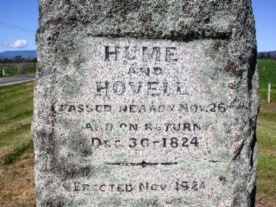
Photographed by Peter Mackie, September 18, 2009
1. Hume and Hovell Marker
Erected 1924.
Topics. This historical marker is listed in these topic lists: Colonial Era • Exploration. A significant historical year for this entry is 1824.
Location. 36° 35.65′ S, 146° 22.983′ E. Marker is near Moyhu, Victoria, in Wangaratta Rural. It is at the intersection of Wangaratta Whitfield Road and Boggy Creek Road, on the right when traveling south on Wangaratta Whitfield Road. Touch for map. Marker is at or near this postal address: 2799 Boggy Creek Rd, Moyhu VIC 3732, Australia. Touch for directions.

Regionally, it is in Oceania, in Australasia, in the Pacific Ocean, in South Pacific, on the Pacific Rim, in the Western World, and in the Anglosphere. Historically, it finds itself in what was once a British colony.
Regarding Hume and Hovell. Hume and Hovell were the first European explorers to traverse the countryside between Sydney and what is now Melbourne, Australia. Their reports led to the opening up of vast tracts of land between those places, although a settlement at Melbourne lay ten years into the future. In
this page online
Additional keywords. exploration
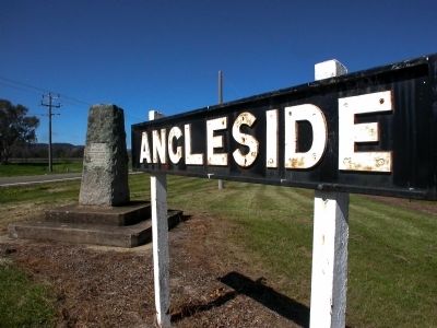
Photographed by Peter Mackie, September 18, 2009
2. Two historical markers.
Angleside was a station on the now-dismantled Wangaratta-Whitfield Railway.
Credits. This page was last revised on February 16, 2022. It was originally submitted on March 30, 2015. This page has been viewed 955 times since then and 35 times this year. Photos: 1, 2. submitted on March 30, 2015. • Bill Pfingsten was the editor who published this page.
