Loudon in Loudon County, Tennessee — The American South (East South Central)
Loudon Railroad Bridge
Strategic Crossing
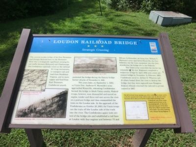
Confederate guards protected the bridge during the famous bridge burner attacks of November 8, 1861.
Two years later, on September 1, 1863, as Union Gen. Ambrose E. Burnside's army approached Knoxville, retreating Confederates burned the bridge to block Union cavalry. Federal troops, however, soon dismantled and moved an engine, tender and three rail cars across the river on a pontoon bridge and then reassembled the train on the Loudon side. At the approach of the Confederates on October 28, 1863, the Union troops ran the train off the Loudon side of the track into the river. The Confederates again took control of the bridge site and established a rail base at Loudon with four engines and between 75 and 100 cars. In December, as Union Gen. William T. Sherman's army approached Knoxville, the Confederates ran the train equipment in the river, abandoning the bridge site to the Federals.
The Union army controlled the site for the remainder of the war. Engineers completed a temporary bridge by April 1864 and a more permanent bridge by November. In February 1865, Confederate naval Lt. Arthur D. Wharton and 19 others boated down the river to destroy the bridge, but they were captured near Kingston. Federal officials returned the railroad to private control in 1867.
(sidebar)
The hill in front of you includes one of the Confederate redans (earthworks for cannons and troops with an open rear) on this side of the Tennessee River that protected the Loudon Railroad Bridge. Both Confederates and Union troops camped and built huts on the surrounding hills. At the time, this land was part of the John Blair farm. Blair's summer house still stands—the white dwelling with columns facing Highway 11.
(captions)
Sweetwater to Knoxville, 1864 Courtesy Library of Congress
Loudon Railroad Bridge 1864 - Courtesy National Archives
Loudon Temporary Bridge, Harper's Weekly, Apr. 9, 1864
Redan, Official Military Atlas of the Civil War
Erected by Tennessee Civil War Trails.
Topics and series. This historical marker is listed in these topic lists: Bridges & Viaducts • Railroads & Streetcars • War, US Civil. In addition, it is included in the Tennessee Civil War Trails series list. A significant historical month for this entry is February 1865.
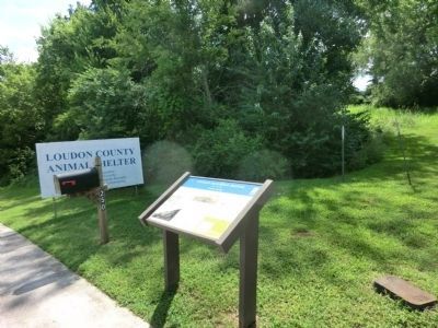
Location. 35° 45.396′ N, 84° 19.339′ W. Marker is in Loudon, Tennessee, in Loudon County. Marker is on Jamie Drive, 0.1 miles south of Natalie Boulevard, on the right when traveling south. The marker is located in the Sugar Limb Industrial Park and at the entrance to the Loudon County Animal Shelter. Touch for map. Marker is at or near this postal address: 250 Jamie Drive, Loudon TN 37774, United States of America. Touch for directions.
Other nearby markers. At least 8 other markers are within 4 miles of this marker, measured as the crow flies. Railroad Trestle (approx. 0.8 miles away); Longstreet's Crossing (approx. 1.2 miles away); Loudon County Confederate Memorial (approx. 1.3 miles away); Sgt. Mitchell W. Stout (approx. 1.3 miles away); Loudon County Courthouse (approx. 1.3 miles away); Dunbar Rosenwald School (approx. 1˝ miles away); Loudon County World War II Memorial (approx. 3.9 miles away); Loudon County World War I Memorial (approx. 3.9 miles away). Touch for a list and map of all markers in Loudon.
Credits. This page was last revised on January 5, 2023. It was originally submitted on October 17, 2013, by Don Morfe of Baltimore, Maryland. This page has been viewed 1,391 times since then and 91 times this year. Last updated on April 7, 2015, by J. Makali Bruton of Accra, Ghana. Photos: 1, 2. submitted on October 17, 2013, by Don Morfe of Baltimore, Maryland. • Bill Pfingsten was the editor who published this page.

