Spring Hill in Maury County, Tennessee — The American South (East South Central)
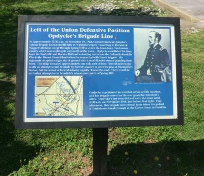
Left of the Union Defensive Position
Opdycke's Brigade Line
Photographed by Don Morfe, April 23, 2014
1. Left of the Union Defensive Position Marker
Opdycke experienced no combat action at this location, and his brigade served as the rear guard for Schofield’s army. Opdycke’s last men did not leave the town until 5:00 a.m. on November 30th, just before first light. That afternoon,
this page online
(captions)
(lower left) Map by Chuck Brown, White Star Consulting, 1996
(upper right) Ken C. Turner Collection, courtesy Blue Acorn Press
Topics. This historical marker is listed in this topic list: War, US Civil. A significant historical date for this entry is November 29, 1864.
Location. 35° 44.573′ N, 86° 55.63′ W. Marker is in Spring Hill, Tennessee, in Maury County. It can be reached from Kedron Road 0.2 miles north of Old Kedron Road, on the left when traveling north. The marker is located on the entrance road to Spring Hill Battlefield-Jerry Erwin Park. Touch for map. Marker is in this post office area: Spring Hill TN 37174, United States of America. Touch for directions.

Regionally, this marker is in Middle Tennessee and in Greater Nashville. It is also in the American South and specifically in the Upper South. Globally, it is in North America, the Western Hemisphere, the Western World, and the Anglosphere. Historically, it finds itself in what was once the territory of the Mississippian Culture, one of the Confederate
Photographed by Don Morfe, April 23, 2014
2. Left of the Union Defensive Position Marker
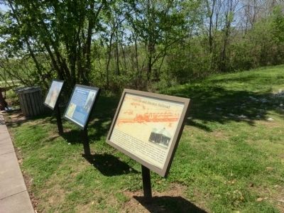
Other nearby markers. At least 8 other markers are within walking distance of this marker: Ewell Farm (here, next to this marker); Nashville and Decatur Railroad (here, next to this marker); Federal Defense of Spring Hill (approx. 0.3 miles away); Cleburne's Attack (approx. 0.3 miles away); Cleburne's Pursuit (approx. 0.4 miles away); Confederate Deployment (approx. 0.4 miles away); Forrest's 3:00 p.m. Cavalry Attack (approx. 0.4 miles away); Confederate Attacks at Spring Hill (approx. 0.4 miles away). Touch for a list and map of all markers in Spring Hill.
Credits. This page was last revised on June 16, 2016. It was originally submitted on July 5, 2014, by Don Morfe of Baltimore, Maryland. This page has been viewed 889 times since then and 42 times this year. Last updated on April 8, 2015, by J. Makali Bruton of Washington, District of Columbia. Photos: 1, 2. submitted on July 5, 2014, by Don Morfe of Baltimore, Maryland. • Bill Pfingsten was the editor who published this page.
