
Tellico Plains in Monroe County, Tennessee — The American South (East South Central)
Coker Creek
Caught in the Middle
Photographed by Don Morfe, April 25, 2014
1. Coker Creek Marker
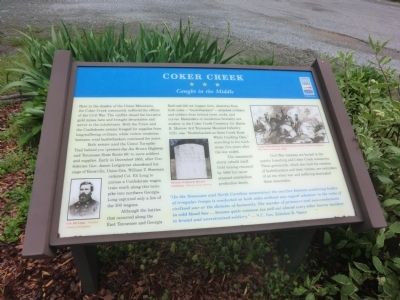
Both armies used the Unicoi Turnpike Trail behind you (present-day Joe Brown Highway and Tennessee State Route 68) to move soldiers and supplies. Early in December 1863, after Confederate Gen. James Longstreet abandoned his siege of Knoxville, Union Gen. William T. Sherman ordered Col. Eli Long to pursue a Confederate wagon train south along this turnpike into northern Georgia. Long captured only a few of the 300 wagons.
Although the battles that occurred along the East Tennessee and Georgia Railroad did not happen here, deserters from both sides—“bushwhackers”—attacked civilians and soldiers from behind trees, rocks, and curves. Reminders of murderous brutality are evident in the Coker Creek Cemetery. Lt. James K. Morrow,
this page online
The community slowly rebuilt itself. Gold mining resumed by 1869 but never attained antebellum production levels.
Civil War veterans are buried in the nearby Ironsburg and Coker Creek cemeteries. These graveyards, which also hold the remains of bushwhackers and their victims, are reminders of an era when war and suffering dominated these mountains.
“(In the Tennessee and North Carolina mountains) the warfare between scattering bodies of irregular troops is conducted on both sides without any regard whatever to the rules of civilized war or the dictates of humanity. The murder of prisoners and non-combatants in cold blood has …become quite common (as well as) almost every other horror incident to brutal and unrestrained soldiery.” — N.C. Gov. Zebulon B. Vance
(captions)
(lower left) Col. Eli Long - Courtesy Library of Congress
(center) Reverse of James K. Morrow tombstone - Monroe County Archives
(upper right) “Union Bushwhackers
Photographed by Don Morfe, April 25, 2014
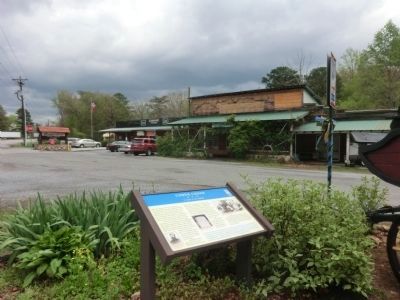
2. Coker Creek-Welcome Center
Erected by Tennessee Civil War Trails.
Topics and series. This historical marker is listed in this topic list: War, US Civil. In addition, it is included in the Tennessee Civil War Trails series list. A significant historical month for this entry is December 1863.
Location. 35° 15.496′ N, 84° 17.477′ W. Marker is in Tellico Plains, Tennessee, in Monroe County. It is at the intersection of Tennessee Route 68 and Joe Brown Highway (County Route 40), on the left when traveling south on Tennessee Route 68. The marker is on the grounds of the Coker Creek Welcome Center in the Cherokee National Forest. Touch for map. Marker is in this post office area: Tellico Plains TN 37385, United States of America. Touch for directions.

Regionally, this marker is in East Tennessee. It is also in the American South, specifically in the Upper South, in Appalachia, and specifically in Southern Appalachia. Globally, it is in North America, the Western Hemisphere, the Western World, and the Anglosphere. Historically, it finds itself in what was once the original Cherokee Nation,
Photographed by Don Morfe, April 25, 2014
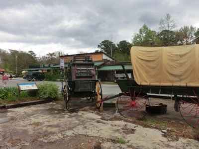
3. Wagons near the Marker
Other nearby markers. At least 8 other markers are within 8 miles of this marker, measured as the crow flies: Gold Mining at Coker Creek (within shouting distance of this marker); Unicoi Turnpike Trail (within shouting distance of this marker); Early Gold Mining (within shouting distance of this marker); Tellico Tales: Former City Hall (approx. 7.2 miles away); Tellico Tales: School House Hill (approx. 7.2 miles away); Tellico Tales: Scott Street (approx. 7.2 miles away); Tellico Tales: Memorial Drive (approx. 7.2 miles away); Tellico Tales: Veterans Memorial (approx. 7.2 miles away). Touch for a list and map of all markers in Tellico Plains.
Photographed by Don Morfe, April 25, 2014
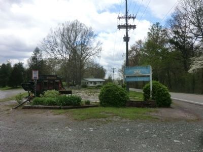
4. Coker Creek-distant shot of the back of the marker
Photographed by Don Morfe, April 25, 2014
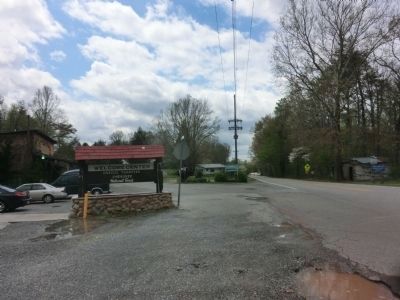
5. Coker Creek-Welcome Center
Credits. This page was last revised on November 22, 2019. It was originally submitted on July 15, 2014, by Don Morfe of Baltimore, Maryland. This page has been viewed 1,933 times since then and 80 times this year. Last updated on April 9, 2015, by J. Makali Bruton of Washington, District of Columbia. Photos: 1, 2, 3, 4, 5. submitted on July 15, 2014, by Don Morfe of Baltimore, Maryland. • Bill Pfingsten was the editor who published this page.
