
Tellico Plains in Monroe County, Tennessee — The American South (East South Central)
Unicoi Turnpike Trail
Path Through Time
Photographed by Don Morfe, April 25, 2014
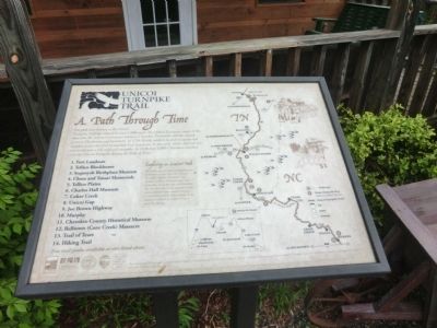
1. Unicoi Turnpike Trail Marker
Exploring an Ancient Path
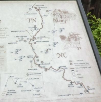
We invite you to travel through layers of history as you trace the Unicoi Turnpike Trail in Tennessee and North Carolina. Historic sites and museums along the way will illustrate the role this important transportation route played in our nation’s history. A two and one half mile section of the original roadbed at Coker Creek is open for hiking.
Map points
1. Fort Loudoun; 2. Tellico Blockhouse; 3. Sequoyah Birthplace Museum; 4. Chato and Tanasi Memorials; 5. Tellico Plains; 6. Charles Hall Museum; 7. Coker Creek; 8. Unicoi Gap; 9. Joe Brown Highway; 10. Murphy; 11. Cherokee County Historical Museum; 12. Belltown
this page online
Erected by John D. Grubb and Louise G. Summer Fund for Monroe County, Tennessee Overhill Association and State of Tenneessee.
Topics and series. This memorial is listed in these topic lists: Indigenous Peoples and Communities • Settlements & Settlers. In addition, it is included in the Trail of Tears series list. A significant historical year for this entry is 1756.
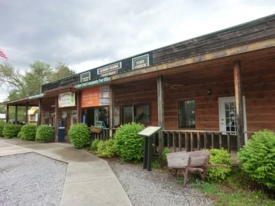
Location. 35° 15.516′ N, 84° 17.448′ W. Memorial is in Tellico Plains, Tennessee, in Monroe County. It is on U.S. 68. The marker is located on the grounds of the Welcome Center, Unicoi Turnpike, Cherokee National Forest and Cedar Creek Post Office. Touch for map. Memorial is in this post office area: Tellico Plains TN 37385, United States of America. Touch for directions.

Regionally, this memorial is in East Tennessee. It is also in the American South, specifically in the Upper South, in Appalachia, and specifically in Southern Appalachia. Globally, it is in North America, the Western Hemisphere, the Western World, and the Anglosphere. Historically, it finds itself in what was once the original
Photographed by Don Morfe, April 25, 2014
2. Unicoi Turnpike Trail Marker
Other nearby markers. At least 8 other markers are within 8 miles of this marker, measured as the crow flies: Gold Mining at Coker Creek (a few steps from this marker); Early Gold Mining (a few steps from this marker); Coker Creek (within shouting distance of this marker); Tellico Tales: Former City Hall (approx. 7.2 miles away); Tellico Tales: School House Hill (approx. 7.2 miles away); Tellico Tales: Scott Street (approx. 7.2 miles away); Tellico Tales: Memorial Drive (approx. 7.2 miles away); Tellico Tales: Veterans Memorial (approx. 7.2 miles away). Touch for a list and map of all markers in Tellico Plains.
Photographed by Don Morfe, April 25, 2014
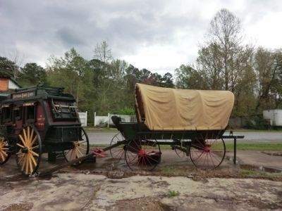
3. Unicoi Turnpike Trail Welcome Center
Photographed by Don Morfe, April 25, 2014
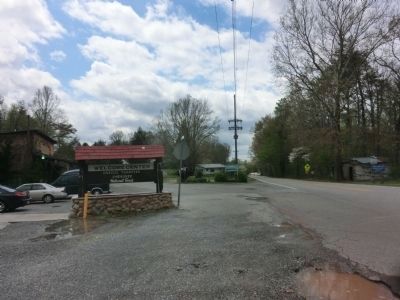
4. Unicoi Turnpike Trail Welcome Center
Photographed by Don Morfe, April 25, 2014
5. Close up of map shown on the marker
Credits. This page was last revised on June 16, 2016. It was originally submitted on July 15, 2014, by Don Morfe of Baltimore, Maryland. This page has been viewed 1,046 times since then and 40 times this year. Last updated on April 9, 2015, by J. Makali Bruton of Washington, District of Columbia. Photos: 1, 2, 3, 4, 5. submitted on July 15, 2014, by Don Morfe of Baltimore, Maryland. • Bill Pfingsten was the editor who published this page.
