Cheektowaga in Erie County, New York — The American Northeast (Mid-Atlantic)
Bellevue
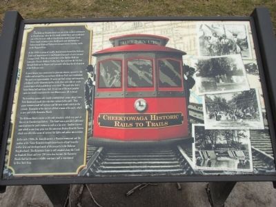
Cheektowaga Historic Rails to Trails
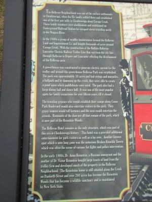
In the 1880s a group of wealthy businessmen formed the Bellevue Land and Improvement Co. and bought thousands of acres around Cayuga Creek. With the construction of the Buffalo-Bellevue-Lancaster Electric Railway Trolley Line that ran from the city line through Bellevue to Depew and Lancaster effecting the development of the Bellevue area.
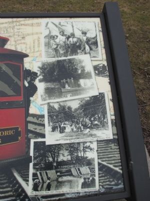
A powerhouse was constructed to generate electric current for the trolley and around this powerhouse Bellevue Park was established. The park was aproximately 30 acres and had swings and maypoles, a ballpark and by damming up the creek, they were able to create a pond upon which paddleboats were used. The park also had a large dining hall and dance hall. It was one of the most popular spots for family excursions for over fifteen years, till it closed.
Traveling gypsies who would establish their camps along Como Park Boulevard would also entertain visitors to the park. They [sic] gypsy women would tell fortunes and the men would entertain the crowds. Remnants of the dam are all that remain of the park, which is now part of the Reinstein Woods.
The Bellevue Hotel remains as the only structure, which was part of this era in Cheektowga history. This hotel was a [sic] provided additional entertainment for park visitors as well as a lay over. Another layover spot which is now long gone was the notorious Broken Knuckle Tavern which was often the scene of various fist fights and police intervention.
In the early 1900s, Dr. Anna Reinstein, a Russian immigrant and the mother of Dr. Victor Reinstein bought large tracts of land from the trolley firm and developed much of the property in the Bellevue neighborhood. The Reinsteins home is still situated along the Creek on Danforth Street and over 200 acres has become the Reinstein Woods that has become a wildlife sanctuary and is maintained by New York State.
[photo captions]Gypsies at Bellevue Park - circa 1900. Canoeing at Belleview Park. The good old summer time - Bellevue Park. The Bellevue Dam 1907 - young boy on the dam is Dr. Victor Reinstein.
Topics. This historical marker is listed in these topic lists: Abolition & Underground RR • Entertainment • Railroads & Streetcars • Settlements & Settlers. A significant historical year for this entry is 1900.
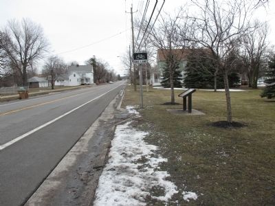
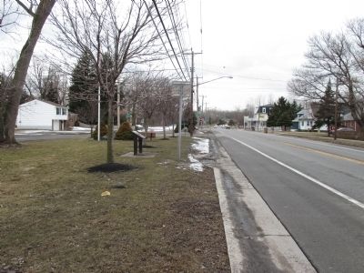
Location. 42° 53.595′ N, 78° 44.164′ W. Marker is in Cheektowaga, New York, in Erie County. Marker is at the intersection of Como Park Boulevard and Park Street, on the right when traveling east on Como Park Boulevard. Marker is in a triangular green space with a segmented apex. Touch for map. Marker is in this post office area: Buffalo NY 14227, United States of America. Touch for directions.
Other nearby markers. At least 8 other markers are within 3 miles of this marker, measured as the crow flies. Site of Underground Railway Station (about 600 feet away, measured in a direct line); Forks (approx. 0.9 miles away); Site of Toll Gate (approx. 1.1 miles away); This Memorial (approx. 1.1 miles away); Heroic Dead (approx. 1.1 miles away); The Original Site of Forks Hose Company #2 (approx. 1.2 miles away); Buffalo Creek Indian Reservation North Boundary (approx. 1.9 miles away); Earliest Church (approx. 2˝ miles away). Touch for a list and map of all markers in Cheektowaga.
Also see . . . Reinstein Woods - New York State Department of Environmental Conservation. (Submitted on April 10, 2015, by Anton Schwarzmueller of Wilson, New York.)
Credits. This page was last revised on June 16, 2016. It was originally submitted on April 10, 2015, by Anton Schwarzmueller of Wilson, New York. This page has been viewed 926 times since then and 76 times this year. Photos: 1, 2, 3, 4, 5. submitted on April 10, 2015, by Anton Schwarzmueller of Wilson, New York.
