Near Hancock in Washington County, Maryland — The American Northeast (Mid-Atlantic)
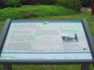
The National Road
The Road that Built the Nation
— The Historic National Road - The Road That Built The Nation —
“. . . so many happy people, restless in the midst of abundance.” —Alexis de Tocqueville, 1840.
Americans are an adventurous people. From past to present, they have used feet, horses, wagons, stagecoaches, canals, railroads, bicycles, automobiles, trucks and buses to “perpetually change their plans and abodes.”
Centuries ago, George Washington dreamed of a highway joining east and west. In 1806, Thomas Jefferson made that roadway a reality when he risked his Presidency by authorizing, “an Act to regulate the laying out and making [of] a road from Cumberland in the State of Maryland to the State of Ohio.”
The next generation built that “United States Road,” a thirty-foot wide, crushed stone thoroughfare that spanned rivers, traversed mountains and opened up America’s western frontier to the Mississippi. Merchants, traders and families from all over the world journeyed along this route in their quest to claim land, expand markets and form new lives.
Today, you can trace that same path along the Historic National Road. Discover the places, events and stories that shaped this nation. To have your own adventure, stop by any Welcome Center or local visitor center to speak to a travel counselor and pick up a Historic National Road map-guide.
(sidebar) Built in the early 1800s, a paved highway west was America’s first federal project. Much of the approximately 800 mile long National Road is still marked by historic milestones.
(photo caption) Are we there yet? These early 20th century travelers speak to all of us who at one time or another couldn’t wait to get out of the car. Today, we have the luxury of taking our modern interstates for granted. But who can’t relate to those faces?
Topics and series. This historical marker is listed in this topic list: Roads & Vehicles. In addition, it is included in the Former U.S. Presidents: #03 Thomas Jefferson, and the The Historic National Road series lists. A significant historical year for this entry is 1840.
Location. This marker has been replaced by another marker nearby. It was located near 39° 43.129′ N, 78° 16.84′ W. Marker was near Hancock, Maryland, in Washington County. Marker was on the westbound Sideling Hill Visitors Center (Interstate 68 at milepost 75) near Exit 77 (Maryland Route 144), on the right when traveling west. Touch for map. Marker was in this post office area: Hancock MD 21750, United States of America. Touch for directions.
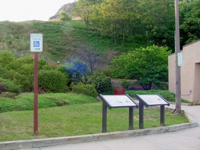
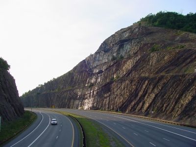
Other nearby markers. At least 5 other markers are within walking distance of this location. The Challenge of Sideling Hill (here, next to this marker); a different marker also named The National Road (here, next to this marker); Gettysburg Campaign (a few steps from this marker); Sideling Hill Cut South Bench (within shouting distance of this marker); Interstate 68 Maryland Vietnam Memorial (about 400 feet away, measured in a direct line). Touch for a list and map of all markers in Hancock.
Related marker. Click here for another marker that is related to this marker. This marker has been replaced by the linked marker.
Credits. This page was last revised on March 24, 2024. It was originally submitted on January 20, 2007, by J. J. Prats of Powell, Ohio. This page has been viewed 2,141 times since then and 19 times this year. Photos: 1, 2, 3. submitted on January 20, 2007, by J. J. Prats of Powell, Ohio.


