
Youngstown in Niagara County, New York — The American Northeast (Mid-Atlantic)
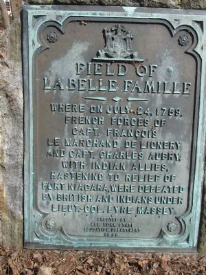
Field of La Belle Famille
Photographed by Anton Schwarzmueller, April 19, 2015
1. Field of LaBelle Famille Marker
La Belle Famille
—•—
Where on July 24, 1759,
French forces of
Capt. Francois
Le Marchand De Lignery
and Capt. Charles Aubry,
with Indian allies,
hastening to the relief of
Fort Niagara, were defeated
by British and Indians under
Lieut.-Col. Eyre Massey.
Erected 1936 by New York State Education Department.
Topics. This historical marker is listed in this topic list: War, French and Indian. A significant historical date for this entry is July 24, 1759.
Location. 43° 14.502′ N, 79° 3.045′ W. Marker is in Youngstown, New York, in Niagara County. It is on River Road (New York State Route 18F at milepost 5.8), 0.1 miles south of Swain Road, on the right when traveling north. Touch for map. Marker is at or near this postal address: 914 River Road, Youngstown NY 14174, United States of America. Touch for directions.

Regionally, this marker is in Upstate New York, specifically in Western New York, and in the Buffalo Metropolitan Area. It is also in the American Northeast and in the Mid-Atlantic. Globally, it is in North America, on the Great Lakes, in the Western Hemisphere, in the Western World, and
this page online
Other nearby markers. At least 8 other markers are within walking distance of this marker: La Belle Famille (within shouting distance of this marker); a different marker also named La Belle Famille (within shouting distance of this marker); Fox Point Battery (about 500 feet away, measured in a direct line); The Site of John Young Store (approx. half a mile away); a different marker also named La Belle Famille (approx. 0.6 miles away); The Site of El Dorado Hotel (approx. 0.6 miles away); Betsy Doyle (approx. 0.7 miles away); Capture of Fort Niagara 1813 (approx. 0.7 miles away in Canada). Touch for a list and map of all markers in Youngstown.
Also see . . . Battle of La Belle-Famille - Wikipedia. (Submitted on April 20, 2015, by Anton Schwarzmueller of Wilson, New York.)
Photographed by Anton Schwarzmueller, April 19, 2015
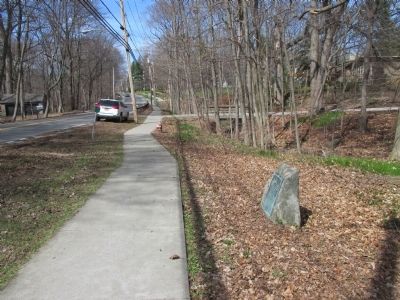
2. Northward
Photographed by Anton Schwarzmueller, April 19, 2015
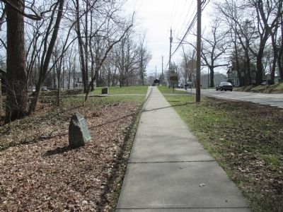
3. Southward
Two other markers in background (stone and sign).
Photographed by Anton Schwarzmueller, April 19, 2015
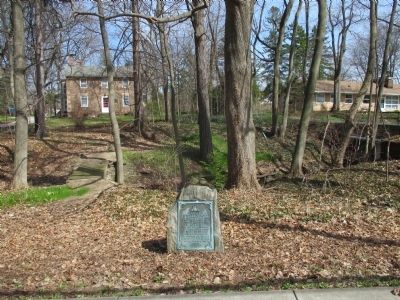
4. Field of La Belle Famille Marker
Credits. This page was last revised on June 16, 2016. It was originally submitted on April 20, 2015, by Anton Schwarzmueller of Wilson, New York. This page has been viewed 727 times since then and 41 times this year. Photos: 1, 2, 3, 4. submitted on April 20, 2015, by Anton Schwarzmueller of Wilson, New York.
