
Murfreesboro in Rutherford County, Tennessee — The American South (East South Central)
Wheeler's Raid around Rosecrans
Dec. 29, 1862
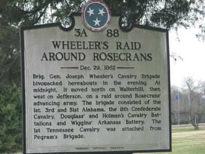
Photographed by Tom Gillard, December 30, 2009
1. Wheeler's Raid around Rosecrans Marker
Erected by Tennessee Historical Commission. (Marker Number 3A 88.)
Topics and series. This historical marker is listed in this topic list: War, US Civil. In addition, it is included in the Tennessee Historical Commission series list.
Location. 35° 54.792′ N, 86° 23.02′ W. Marker is in Murfreesboro, Tennessee, in Rutherford County. It is on Lebanon Road (U.S. 231), on the right when traveling north. In front of the Veterans Administration Hospital. Touch for map. Marker is in this post office area: Murfreesboro TN 37129, United States of America. Touch for directions.

Regionally, this marker is in Middle Tennessee and in Greater Nashville. It is also in the
this page online
Other nearby markers. At least 8 other markers are within 3 miles of this marker, measured as the crow flies: Battle of Stones River (approx. 2.8 miles away); McFadden's Ford (approx. 2.8 miles away); My Poor Orphans! (approx. 2.9 miles away); Remembering by Rail (approx. 2.9 miles away); Battle at Stones River (approx. 2.9 miles away); The Very Forest Seemed to Fall (approx. 2.9 miles away); Bethel Methodist Church (approx. 2.9 miles away); Stones River Artillery Monument (approx. 2.9 miles away). Touch for a list and map of all markers in Murfreesboro.
Other markers no longer nearby. McFadden Farm (was approx. 2.8 miles away but has been confirmed missing); Breckinridge's Attack (was approx. 2.9 miles away but has been permanently removed); Artillery Saves the Day (was approx. 2.9 miles away but has been reported
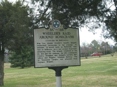
Photographed by Tom Gillard, December 30, 2009
2. Wheeler's Raid around Rosecrans Marker
Also see . . . Joseph Wheeler. (Submitted on December 31, 2009, by Tom Gillard of Tullahoma, Tennessee.)
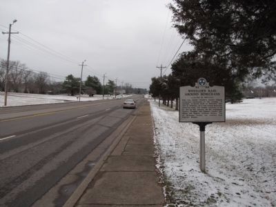
Photographed by Lee Hattabaugh, January 26, 2011
3. Wheeler's Raid around Rosecrans Marker
Looking north on Lebanon Pike (US 231)
Credits. This page was last revised on June 3, 2021. It was originally submitted on December 31, 2009, by Tom Gillard of Tullahoma, Tennessee. This page has been viewed 1,900 times since then and 56 times this year. Last updated on April 21, 2015, by J. Makali Bruton of Washington, District of Columbia. Photos: 1, 2. submitted on December 31, 2009, by Tom Gillard of Tullahoma, Tennessee. 3. submitted on February 2, 2011, by Lee Hattabaugh of Capshaw, Alabama. • Bill Pfingsten was the editor who published this page.
