
Bastrop in Bastrop County, Texas — The American South (West South Central)
Wilbarger's Bend
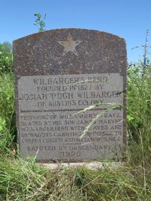
Photographed by Richard Denney, April 21, 2015
1. Wilbarger's Bend Marker
Beginning of Wilbarger's Trace, blazed by his son James Harvey Wilbarger 1860 with slaves and ox-wagons carrying commerce to Corpus Christi and Matamoros, Mex.
Erected 1926 by Wilbarger Descendants.
Topics. This historical marker is listed in these topic lists: Industry & Commerce • Roads & Vehicles • Settlements & Settlers. A significant historical year for this entry is 1827.
Location. 30° 10.545′ N, 97° 24.934′ W. Marker is in Bastrop, Texas, in Bastrop County. It is at the intersection of Farm to Market Road 969 and Wilbarger Bend (County Route 65), on the right when traveling west on Route 969. Touch for map. Marker is in this post office area: Bastrop TX 78602, United States of America. Touch for directions.

Regionally, this marker is in Central Texas and in the Austin Metropolitan Area. It is also in the American South. Globally, it is in North America, a Gulf of Mexico state, the Western Hemisphere, the Western World, and the Anglosphere. Historically, it finds itself in what was once New Spain, the Republic of Texas, one
this page online
Other nearby markers. At least 8 other markers are within 6 miles of this marker, measured as the crow flies: Union Hill Missionary Baptist Church (approx. 0.9 miles away); Bluff Trail Overlook (approx. 2.9 miles away); Site of the Home of Col. Robert M. Coleman (approx. 4½ miles away); Kings Highway Camino Real — Old San Antonio Road (approx. 4.6 miles away); George Self (approx. 5.8 miles away); Joseph J. Manor Cemetery (approx. 5.8 miles away); David Crawford Edmiston (approx. 5.8 miles away); James Euwin Edmiston (approx. 5.8 miles away). Touch for a list and map of all markers in Bastrop.
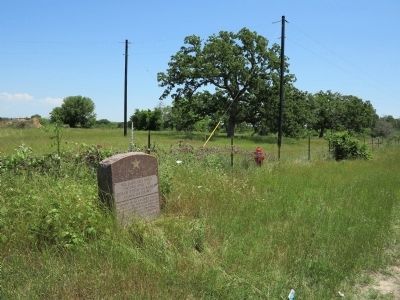
Photographed by Richard Denney, April 21, 2015
2. Wilbarger's Bend Marker
Credits. This page was last revised on June 16, 2016. It was originally submitted on April 22, 2015, by Richard Denney of Austin, Texas. This page has been viewed 1,301 times since then and 57 times this year. Photos: 1, 2. submitted on April 22, 2015, by Richard Denney of Austin, Texas. • Bernard Fisher was the editor who published this page.
