Near Elgin in Bastrop County, Texas — The American South (West South Central)
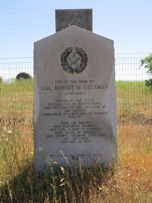
Site of the Home of Col. Robert M. Coleman
— (1799 -1837) —
Declaration of Independence
Aide-de-camp to Gen. Houston at
San Jacinto
Commander of a regiment of Rangers
1836-37
Here his widow
Mrs. Elizabeth Coleman
and son, Albert V. Coleman
were killed by Indians
and Thomas Coleman, aged five
was captured
February 18, 1839
Erected 1936 by State of Texas. (Marker Number 9171.)
Topics and series. This historical marker is listed in these topic lists: Native Americans • Settlements & Settlers • War, Texas Independence. In addition, it is included in the Texas 1936 Centennial Markers and Monuments series list. A significant historical month for this entry is February 2003.
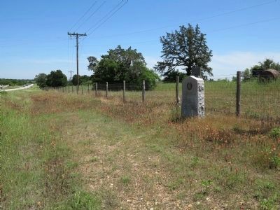
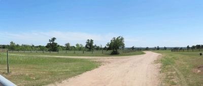
Location. 30° 13.486′ N, 97° 27.95′ W. Marker is near Elgin, Texas, in Bastrop County. Marker is on Farm to Market Road 969, 0.2 miles west of Upper Elgin River Road (County Route 127), on the right when traveling east. Touch for map. Marker is in this post office area: Elgin TX 78621, United States of America. Touch for directions.
Other nearby markers. At least 8 other markers are within 4 miles of this marker, measured as the crow flies. George Self (approx. 1.4 miles away); David Crawford Edmiston (approx. 1˝ miles away); James Euwin Edmiston (approx. 1˝ miles away); Joseph J. Manor Cemetery (approx. 1˝ miles away); Union Lee Baptist Church (approx. 2.4 miles away); Webberville Ebenezer Baptist Church (approx. 2.9 miles away); Webberville (approx. 2.9 miles away); Union Hill Missionary Baptist Church (approx. 3.6 miles away).

Photographed By Richard Denney, April 25, 2015
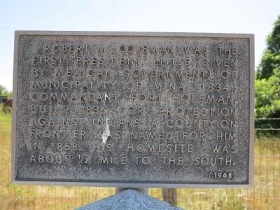
2. Supplemental Marker
Supplemental marker added in 1968 reads: Robert M. Coleman was the first "President" (title given by Mexican government) of Municipality of Mina, 1834; commandant, Fort Coleman, built 1836 for protection against Indians. A county on frontier was named for him in 1858. His homesite was about 1/2 mile to the south.
Credits. This page was last revised on June 16, 2016. It was originally submitted on April 26, 2015, by Richard Denney of Austin, Texas. This page has been viewed 830 times since then and 62 times this year. Photos: 1, 2, 3, 4. submitted on April 26, 2015, by Richard Denney of Austin, Texas. • Bernard Fisher was the editor who published this page.


