Chickamauga in Walker County, Georgia — The American South (South Atlantic)
Sickness at Camp Thomas
Historic Camp Thomas
Photographed by Dale K. Benington, August 19, 2014
1. Sickness at Camp Thomas Marker
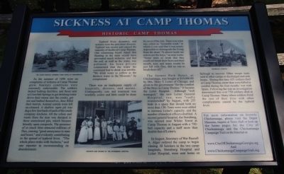
Typhoid fever, dysentery, and malaria were the prevalent diseases. Typhoid was severe and caused the majority of deaths at Camp Thomas. One examining board stated that flooring in the tents would have prevented much sickness, and that the soil, as well as the water, was polluted. An Iowa private commented that the water his command had to drink
this page online
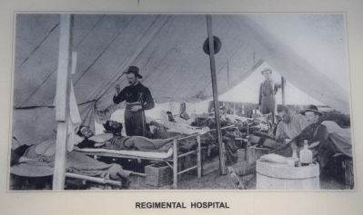
There was an inadequate supply of hospitals, doctors, and nurses. Consequently, care and treatment was woefully scarce and little could be done for most of the sick. There was what was called an "incurable ward," in which it was said that it was nearly impossible to distinguish the living from the dead."It almost made me sick to see the boys," one man wrote. "Some were so weak that they could not brush their faces and their mouth, eyes and noses would be just filled with flies, and no one to brush them off."
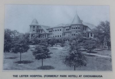
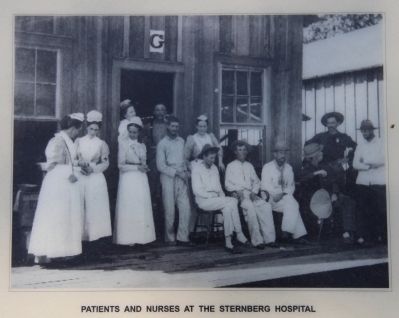
The former Park Hotel, at Chickamauga, was bought at $10,000.00 by Mrs. Mary T. Leiter of Chicago, and given to the government "for the comfort of the Boys at Camp Thomas." It became the Leiter Hospital. Although "well-managed," the new Leiter General Hospital, too, was "sadly overcrowded" by August, with 255 beds in a space that should hold no more than 130. Tents were soon added to increase Leiter's capacity, and the number of medical officers doubled. A second General Hospital, the Sternberg, was opened near Wilder Tower at
Photographed by Dale K. Benington, August 19, 2014
2. Sickness at Camp Thomas Marker
Close-up view, that is displayed on the marker, of the Leiter Hospital (formerly Park Hotel) at Chickamauga.
In August, Secretary of War Russell A. Alger ordered the camps to begin closing. Ill soldiers in the two camp hospitals, Sternberg Hospital and Leiter Hospital, were sent home on furlough to recover. Other troops were sent to other camps or discharged and sent home. During this time 425 soldiers died in Camp Thomas, more than were killed in combat during the four months' war with Spain. Following the war investigation determined that over 750 soldiers died in Camp Thomas. Many others lived the rest of their lives with other complications caused by the typhoid fever.
For more information on historic Chickamauga, please visit the Depot Museum, inquire at Town Hall or look up the homepages for the city of Chickamauga and the Chickamauga campaign trail on the Internet:
and
www.ChickamaugaCampaignTrail.org.
Topics. This historical marker is listed in this topic list: War, Spanish-American. A significant historical year for this entry is 1898.
Location. 34° 52.243′ N, 85° 17.554′ W. Marker is in Chickamauga,
Photographed by Dale K. Benington, August 19, 2014
3. Sickness at Camp Thomas Marker
Close-up view, that is displayed on the marker, of patients and nurses at Sternberg Hospital.

Regionally, this marker is in the Mountains. It is also in the American South, specifically in the Deep South, in Appalachia, and specifically in Southern Appalachia. Globally, it is in North America, the Western Hemisphere, the Western World, and the Anglosphere. Historically, it finds itself in what was once the original Cherokee Nation, the territory of the Mississippian Culture, one of the original Thirteen Colonies, one of the Confederate States of America, and the Antebellum South.
Other nearby markers. At least 8 other markers are within walking distance of this marker: The Town of Lytle (here, next to this marker); Camp George H. Thomas (here, next to this marker); North and South Reunited (here, next to this marker); Crawfish Spring (a few
Photographed by Dale K. Benington, August 19, 2014
4. Sickness at Camp Thomas Marker
Close-up view, that is displayed on the marker, of the Regimental Hospital.
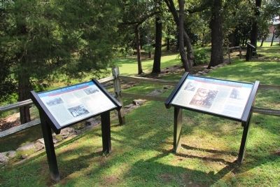
Photographed by Dale K. Benington, August 19, 2014
5. Sickness at Camp Thomas Marker
View of the featured marker, situated to the left of "North and South Reunited" marker.
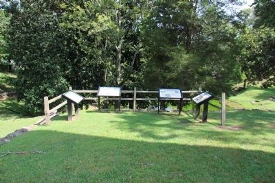
Photographed by Dale K. Benington, August 19, 2014
6. Sickness at Camp Thomas Marker
View of the featured marker, the second on the right of a group of four markers, with the Crawfish Springs in the distant background.
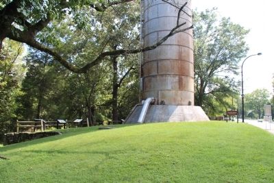
Photographed by Dale K. Benington, August 19, 2014
7. Sickness at Camp Thomas Marker
A distant view of the featured marker, along with several other markers, situated behind the Crawfish Springs water tower.
Credits. This page was last revised on June 16, 2016. It was originally submitted on April 27, 2015, by Dale K. Benington of Toledo, Ohio. This page has been viewed 1,192 times since then and 93 times this year. Last updated on April 27, 2015, by J. Makali Bruton of Washington, District of Columbia. Photos: 1, 2, 3, 4, 5, 6, 7. submitted on April 27, 2015, by Dale K. Benington of Toledo, Ohio. • Bill Pfingsten was the editor who published this page.
