Near West Glacier in Flathead County, Montana — The American West (Mountains)
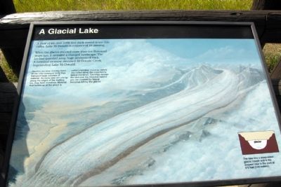
A Glacial Lake
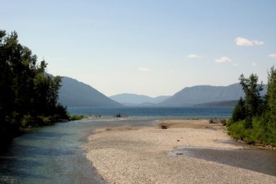
When the glacier receded more than ten thousand years ago, it revealed a changed landscape. The ice had quarried away huge amounts of rock. A terminal moraine dammed McDonald Creek, impounding Lake McDonald.
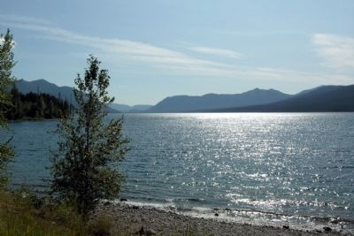
Glaciers are slow-moving rivers of ice. Like conveyor belts they transport large volumes of material. As rocks and dirt pile up along the edges of the melting ice, they form moraines. Material that builds up at the snout is called a terminal moraine; debris deposited along the sides forms lateral moraines. The ridge across the lake and the ridgeline behind you are covered by lateral moraines left by the glacier.
The lake fills a steep-sided glacial trough and is the deepest lake in the park at 472 feet (144 meters).
Erected by National Park Service.
Topics. This historical marker is listed in this topic list: Natural Features.
Location. 48° 36.678′ N, 113° 52.91′ W. Marker is near West Glacier, Montana, in Flathead County. Marker is on Going-to-the-Sun Road, half a mile west of Lake McDonald Lodge Driveway, on the right when traveling west. Marker is located in Glacier National Park; a entry fee may be required. Touch for map. Marker is in this post office area: West Glacier MT 59936, United States of America. Touch for directions.
Other nearby markers. At least 6 other markers are within 11 miles of this marker, measured as the crow flies. Time Machines (approx. 0.4 miles away); Wilderness Architecture (approx. 0.4 miles away); Historic Boats (approx. half a mile away); Horns (approx. 9˝ miles away); Stephen Tyng Mather (approx. 9˝ miles away); Choosing a Route (approx. 10.6 miles away).
Also see . . . Lake McDonald Valley. National Park Service website with information on Lake McDonald and facilities, services, and activities in the area. (Submitted on April 29, 2015.)
Credits. This page was last revised on June 16, 2016. It was originally submitted on April 29, 2015, by Duane Hall of Abilene, Texas. This page has been viewed 373 times since then and 14 times this year. Photos: 1, 2, 3. submitted on April 29, 2015, by Duane Hall of Abilene, Texas.
Editor’s want-list for this marker. Photo of wide-view of marker and surrounding area. • Can you help?


