Vero Beach in Indian River County, Florida — The American South (South Atlantic)
City of Vero Beach
Photographed by Diane Murphy, November 24
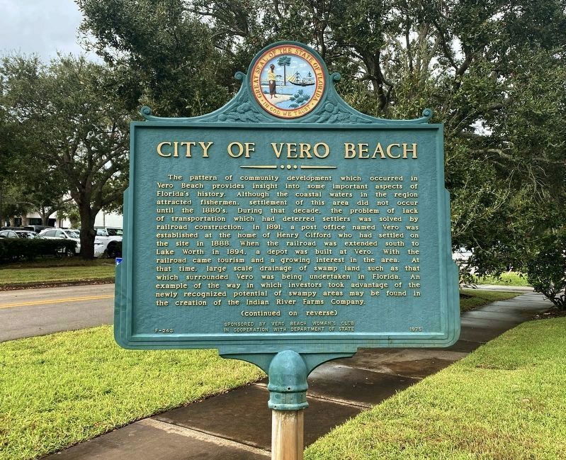
1. City of Vero Beach Marker (front)
The pattern of community development which occurred in Vero Beach provides insight into some important aspects of Florida's history. Although the coastal waters in the region attracted fishermen, settlement of this area did not occur until the 1880s. During that decade the problem of transportation which had deterred settlers was solved by railroad construction. In 1891 a post office named Vero was established at the home of Henry Gifford who had settled on the site in 1880. When the railroad was extended south to Lake Worth, a depot was built at Vero. With the railroad came tourism and a growing interest in the area. At that time, large scale drainage of swamp land such as that which surrounded Vero was being undertaken in Florida. An example of the way in which investors took advantage of the newly recognized potential of swampy areas may be found in creation of the Indian River River Farms Company.
this page online
Erected 1975 by Vero Beach Women's Club. (Marker Number F-243.)
Topics. This historical marker is listed in these topic lists: Agriculture • Industry & Commerce • Railroads & Streetcars • Settlements & Settlers • Waterways & Vessels. A significant historical year for this entry is 1891.
Location. 27° 38.395′ N,
Photographed by Diane Murphy, November 24
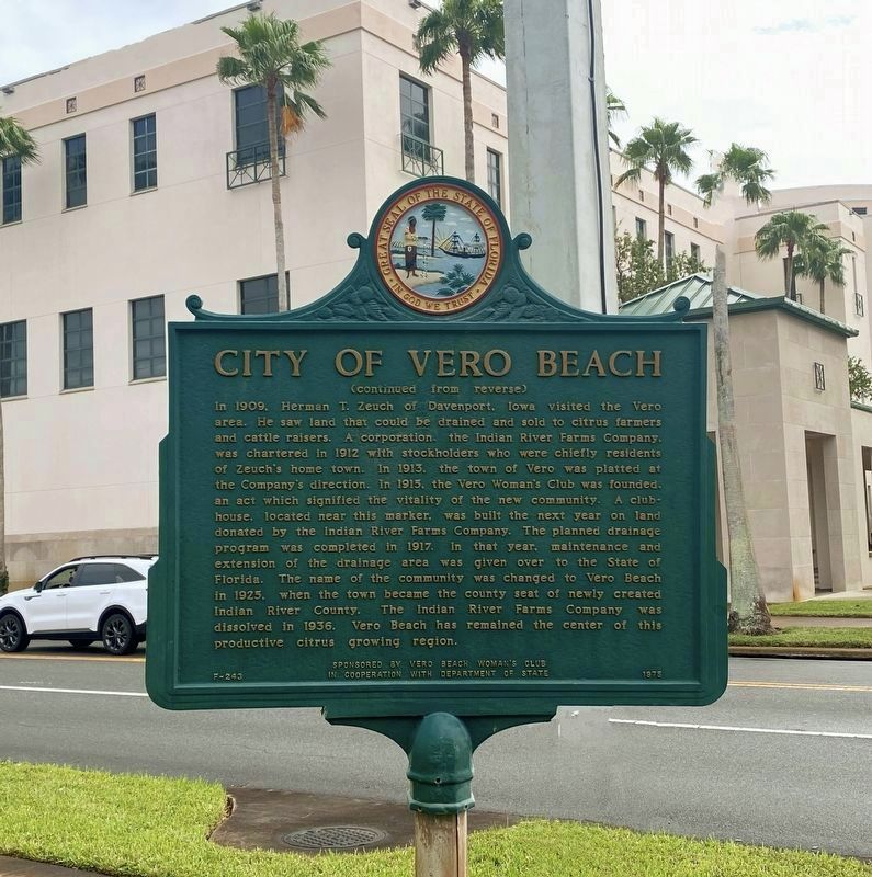
2. City of Vero Beach Marker (back)

Regionally, this marker is in the Space Coast. It is also in the American South and on the Eastern Seaboard. Globally, it is in the North Atlantic Region, North America, a Gulf of Mexico state, the Western Hemisphere, the Western World, and the Anglosphere. Historically, it finds itself in what was once New Spain, the territory of the Mississippian Culture, one of the Confederate States of America, and the Antebellum South.
Other nearby markers. At least 8 other markers are within walking distance of this marker: The Woman’s Club of Vero Beach Florida (a few steps from this marker); Courthouse Executive Center (about 600 feet away, measured in a direct line); Simmons / Seminole Building (about 700 feet away); Centennial Fountain (about 700 feet away); Maher Building (about 700 feet away); The Pueblo Arcade

Photographed by Richard E. Miller, October 28, 2014
3. "City of Vero Beach Marker" at the intersection of 21st Street & 16th Avenue

Photographed by Richard E. Miller, October 28, 2014
4. Turtle sculpture on display outside the nearby Indian River Citrus Museum and Heritage Center
Credits. This page was last revised on November 4, 2024. It was originally submitted on May 1, 2015, by Richard E. Miller of Oxon Hill, Maryland. This page has been viewed 1,068 times since then and 72 times this year. Photos: 1, 2. submitted on November 3, 2024, by Diane Murphy of Saint Cloud, Florida. 3, 4. submitted on May 3, 2015, by Richard E. Miller of Oxon Hill, Maryland. • Bernard Fisher was the editor who published this page.
